
South end: Dead end in Cocodrie Parishes: Terrebonne | North end: LA 24 in Houma Length 41.2 km | |
 | ||
Existed: 1955 renumbering – present Parish Terrebonne Parish, Louisiana | ||
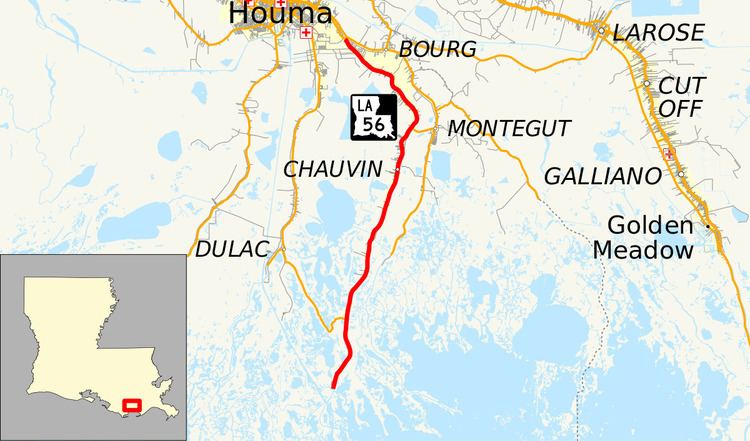
Louisiana Highway 56 is a state highway that serves Terrebonne Parish. It spans 25.6 miles (41.2 km) in a south to north direction along Bayou Petit Caillou, connecting Cocodrie and Houma. It is known locally as Little Caillou Road.
Contents
Map of LA-56, Chauvin, LA 70344, USA
Route description
From the south, LA 56 begins at a dead end in Cocodrie on the west bank of Bayou Petit Caillou. It proceeds north toward Chauvin and intersects LA 57, which parallels LA 56 to Houma. North of Chauvin, LA 56 intersects LA 58 which connects with LA 55 in Montegut just to the east on Bayou Terrebonne. LA 56 reaches its northern terminus at LA 24 in the southeastern corner of Houma, near the Houma-Terrebonne Airport. LA 24 continues northward through Houma and eastward across Bayou Terrebonne toward Larose.
LA 56 serves as the only road for residents of Chauvin to reach Houma, the parish seat of Terrebonne. It is an undivided, two-lane highway for its entire length.
Major intersections
The entire highway is in Terrebonne Parish.