
Length 47.6 km | Parishes: DeSoto | |
 | ||
Existed: 1955 renumbering – present Northeast end: End state maintenance in Kingston Station | ||
Louisiana Highway 5 (LA 5) is a state highway located in DeSoto Parish, Louisiana that runs 29.6 miles (47.6 km) in a general southwest to northeast direction from U.S. Highway 84 (US 84) in Logansport to the Kansas City Southern Railway (KCS) tracks at Kingston Station.
Contents
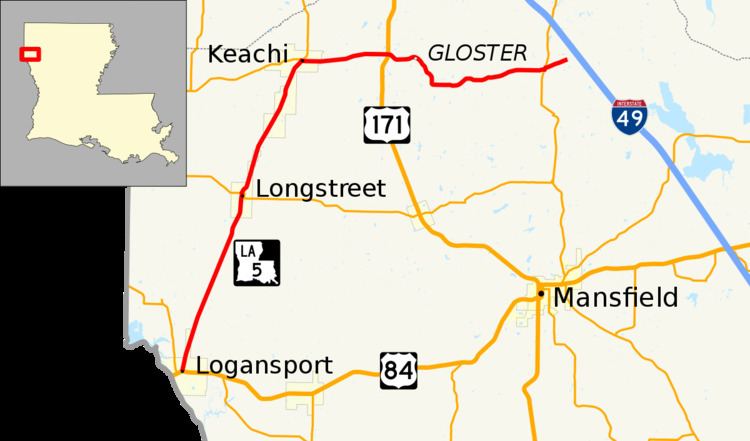
Map of LA-5, Louisiana, USA
An almost entirely rural route, LA 5 is located between the Texas state line and Interstate 49 (I-49) south of Shreveport in the northwest portion of the state. It begins in Logansport as a north–south route and is bannered accordingly. In Keatchi, its direction and bannering switches to west–east. Shortly afterward, LA 5 intersects US 171 at a point known as Kickapoo, just west of Gloster.
Route description
From the southwest, LA 5 begins at an intersection with US 84 (Main Street) in Logansport, 0.5 miles (0.80 km) east of the Texas state line at the Sabine River. It proceeds northward out of town parallel to the Union Pacific Railroad (UP) tracks. After passing through a point known as Funston, LA 5 begins to closely follow the rail line into Longstreet. Here it intersects LA 3015, which heads east to Grand Cane on US 171. Continuing northward along the railroad, LA 5 enters Keatchi. At a four-way intersection, LA 172 heads west to the state line, LA 789 heads north toward Spring Ridge, and LA 5 turns to the east. The route's directional banners reflect the change, reading west–east instead of north–south.
After 4.1 miles (6.6 km), LA 5 intersects US 171 at a point known as Kickapoo. US 171 heads north through Stonewall to Shreveport and south through Grand Cane to Mansfield. Shortly after this junction, LA 5 passes through Gloster and curves to the southeast briefly before resuming a general eastward course. 5.5 miles (8.9 km) later, LA 5 reaches Kingston where it intersects LA 175, connecting to I-49 at Exit 186. LA 5 turns north briefly onto LA 175 before proceeding eastward to a point on the Kansas City Southern Railway (KCS) tracks known as Kingston Station where state maintenance ends. The road continues across the tracks as the locally maintained Mt. Zion Road, crossing over I-49 to serve a rural area on the east side of that highway.
LA 5 is an undivided, two-lane highway for its entire length.
History
In the original Louisiana Highway system in use between 1921 and 1955, the modern LA 5 made up the entirety of two routes: State Route 38 from Logansport to Keachi and State Route 748 from there to Kingston Station.
LA 5 was created with the 1955 Louisiana Highway renumbering, and its route has remained the same apart from the recent smoothing of three zigzags in the route near the junction with US 171. At Kickapoo, LA 5 originally turned south briefly onto US 171 and then east onto Gloster Road, now a local road, before rejoining the present alignment shortly afterward. A new connector was constructed to continue straight across US 171 and curve to meet the original alignment. Immediately to the east in Gloster, LA 5 made a jog to the south and back to the east at the location of a former railroad crossing near Main Street. It rejoined the present alignment directly opposite Jessie Latin Road, turning to the southeast. The construction of a wide curve at this location has replaced both jogs in the route.
Major intersections
The entire highway is in DeSoto Parish.