
South end: Dead end in Delacroix Length 24.3 km | Parishes: St. Bernard | |
 | ||
Existed: 1955 renumbering – present North end: LA 39 / LA 46 in Sebastopol Parish St. Bernard Parish, Louisiana | ||
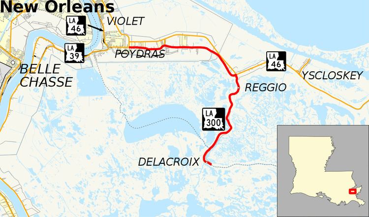
Louisiana Highway 300 (LA 300) is a state highway in Louisiana that serves St. Bernard Parish. It spans 15.1 miles (24.3 km) in a southeast to northwest direction and is bannered north/south. It is known locally as Delacroix Highway and Bayou Road.
Contents
Map of LA-300, St Bernard, LA 70085, USA
Route description
LA 300 is an undivided, two-lane highway for its entire length. From the southeast, LA 300 begins travelling northward from the fishing communities of Delacroix and Reggio. The winding and notoriously dangerous road meets LA 46 north of Reggio and turns westward. This section of LA 300 (which was once part of LA 46) parallels the new four-lane highway carrying LA 46 to the north. About six miles (10 km) from the junction, LA 300 ends at an intersection with LA 39 and LA 46 (East Judge Perez Drive/Bayou Road) in Sebastopol.
Major intersections
The entire highway is in St. Bernard Parish.