
 | ||
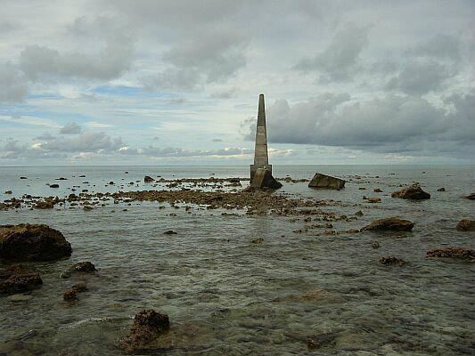
Louisa Reef (known as Nantong Jiao (Chinese: 南通礁) in China and Terumbu Semarang Barat Kecil in Brunei Malay) is a coral atoll in the southern reaches of the Spratly Islands. The reef is oval in shape, approximately 1.5 km east to west and 0.5 km north to south. While most of Louisa Reef is submerged, some portions emerge at low tide and a few small rocks remain above water even at high tide. The atoll rises as deeply undercut walls and steep slopes from very deep water with extensive stony and soft corals. A navigation beacon is at its southwest point and the highest visible rock is at the southeast end.
Map of Louisa Reef
Safe anchorage is difficult to find, depending on the wind and currents, but there are sandy areas at the northwest and southwest ends. The nearest reliable shelter for boats is the lagoon at Swallow Reef, 128 km to the northeast.
Malaysia previously claimed Louisa Reef and operated a small navigational light beacon there. However, Malaysia has apparently dropped its claim in deference to neighbouring Brunei.