
Primary inflows Surface area 2.1 km (0.81 sq mi) Area 210 ha | Basin countries Ireland Surface elevation 57 m Province Ulster | |
 | ||
Primary outflows Lough Nacung Lower, to Clady River | ||
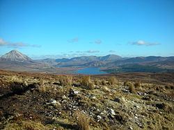
Lough Nacung Upper (Irish: Loch na Cuinge Uachtarach meaning 'Upper Narrowness lake') is a lake in County Donegal, Ireland. It connects Lough Dunlewey to Lough Nacung Lower, which drains into the Clady River. Lough Nacung is a Special Area of Conservation.
Contents
Map of Lough Nacung Upper, Co. Donegal, Ireland
The name is derived from the Irish cuing, meaning "narrow neck of land (as between two lakes)."
References
Lough Nacung Upper Wikipedia(Text) CC BY-SA