
Topo map USGS Harpers Ferry Prominence 80 m | Elevation 358 m Parent range Blue Ridge Mountains | |
 | ||
Location Loudoun County, Virginia / Jefferson County, West Virginia, U.S. Mountain range Appalachian Mountains, Blue Ridge Mountains Similar Short Hill Mountain, Raven Rocks, Lambs Knoll, Quirauk Mountain, Pignut Mountain | ||
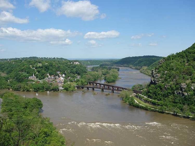
Loudoun Heights, sometimes referred to as Loudoun Mountain, is the first peak of the Blue Ridge Mountain south of the Potomac River in Loudoun County, Virginia and Jefferson County, West Virginia. The northwestern slope is part of Harpers Ferry National Historical Park.
Contents
Map of Loudoun Heights, Harpers Ferry, WV 20132, USA
HistoryEdit
The peak, which overlooks Harpers Ferry, was used by Stonewall Jackson to bombard the town during the Battle of Harpers Ferry. It was also the scene of the first and perhaps worst defeat for Confederate Partisan John Mosby at the hands of the Cole's Maryland Cavalry during the Battle of Loudoun Heights.
RecreationEdit
The Appalachian Trail (AT) traverses the peak before descending its northwestern slope to the Shenandoah River and Harpers Ferry. A spur trail called the Loudoun Heights Trail (the original route of the AT) leads off the AT down the northern slope, passing by Civil War earthworks and providing good views of the confluence of the Potomac and Shenandoah as well as Harpers Ferry, before crossing the Potomac on the U.S. Route 340 bridge and rejoining the AT at Sandy Hook, Maryland.