
Length 10 km | ||
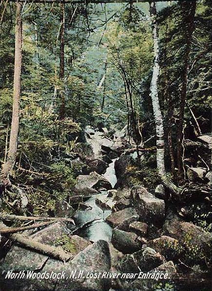 | ||
The Lost River (shown on USGS maps as Moosilauke Brook for part of its course) is a 6.5-mile-long (10.5 km) stream located in the White Mountains of New Hampshire in the United States. It is a tributary of the Pemigewasset River, part of the Merrimack River watershed.
The Lost River begins in Kinsman Notch, one of the major passes through the White Mountains. As it flows through the notch, it passes through Lost River Gorge, an area where enormous boulders falling off the flanking walls of the notch at the close of the last Ice Age have covered the river, creating a network of boulder caves. The gorge is owned by the Society for the Protection of New Hampshire Forests and is operated as a tourist attraction, with trails and ladders accessing many of the caves.
The river flows southeast from Kinsman Notch, turning northeast when joined by Jackman Brook. At this point, the river becomes known as Moosilauke Brook on USGS maps, the name referring to Mount Moosilauke, the 4,810-foot (1,470 m) mountain which rises over the western wall of Kinsman Notch. The river flows through the granite gorge of Agassiz Basin and joins the Pemigewasset River in the village of North Woodstock.
New Hampshire Route 112 follows the Lost River/Moosilauke Brook for the stream's entire length.