
NRHP Reference # 89000337 Added to NRHP 11 May 1989 | Area 52.18 km² | |
 | ||
Location Ironwood Forest, Arizona, United States | ||
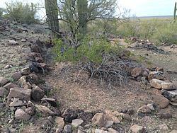
The Los Robles Archaeological District is located in Arizona's Ironwood Forest National Monument and was added to the National Register of Historic Places on May 11, 1989. The district is nearly 13,000 acres and contains over 100 historic and prehistoric archaeological sites, including the Los Robles Platform Mound Community and a trincheras.
Contents
Archaeology
Most of the prehistoric sites were organized into an extensive Hohokam community along the west bank of Los Robles Wash and west into the Samaniego Hills. The Los Robles Community, which dates to between 1150 and 1300 CE, included a series of dispersed small villages, a larger village with a platform mound for ceremonial and other public events, and the large, well-preserved trincheras, or terraced hillside village of Cerro Prieto.
The Los Robles Community was defined as part of the Arizona State Museum's Northern Tucson Basin Survey. This full-coverage survey, with a study area of more than 900 square miles north of Tucson, was designed to increase understanding about the settlement structure of Hohokam desert farmers who lived away from the large irrigation systems of the Salt and Gila Rivers. The resulting site distributions, including those of the Los Robles Community, have provided insights into organizational trends in the Tucson area paralleling those of the densely populated irrigation communities in the Phoenix Basin, thus blurring earlier distinctions by archaeologists between the Desert and River Hohokam.
Detailed studies at Cerro Prieto have also played an important role in changing traditional interpretations of caras de trincheras as defensive refuges. Evidence from Cerro Prieto demonstrates that rather than a fortification it was a large habitation site. The stone terraces and other cobble features may have had residential, ritual, and agricultural functions. Christian Downum, in Between Desert and River: Hohokam Settlement and Land Use in the Los Robles Community, reports on investigations both within the Los Robles Community as a whole, and at its most impressive site of Cerro Prieto. Downum suggests that some of the masonry features at Cerro Prieto, such as massive compounds and dividing walls, were constructed for ceremonial and symbolic purposes.
Vandalism
Despite continuous monitoring by the Arizona Site Stewards and aerial surveillance by the Arizona National Guard during the 1990s, vandalism has been an ongoing problem within Los Robles Archaeological District, as well as elsewhere within Ironwood Forest.
In 2003, George H. Johnson and his Johnson International Inc. illegally bulldozed 270 acres of state trust land in and near Los Robles, causing an estimated $8,000,000 in damage. Several sites were completely destroyed, including areas within the Los Robles Platform Mound Community. In addition, Johnson International Inc. destroyed over 40,000 protected plants, contaminated local water sources by illegally dumping pollutants, and was responsible for the deaths of at least twenty-one endangered Desert bighorn sheep, and the injury of several others.