
Realm NT Countries Venezuela
Colombia | Biome 7 State VU | |
 | ||
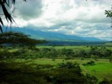
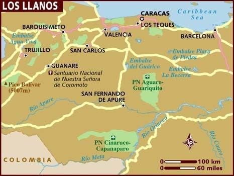
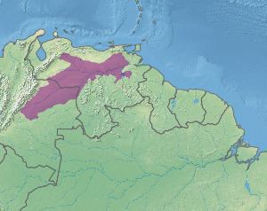
Los Llanos ([ˈʎanos], [ˈʝanos], "The Plains") is a vast tropical grassland plain situated to the east of the Andes in Colombia and Venezuela, in northwestern South America. It is an ecoregion of the flooded grasslands and savannas biome.
Contents
The Llanos' main river is the Orinoco, which forms part of the border between Colombia and Venezuela and is the major river system of Venezuela.
Ecology
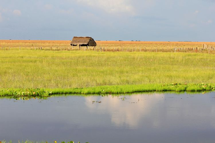
During the rainy season from May to October, parts of the Llanos can flood up to a meter. This turns the woodlands and grassland into a temporary wetland, comparable to the Pantanal of central South America. This flooding also makes the area unique for its wildlife. The area supports around 70 species of water birds, including the scarlet ibis. A large portion of the distribution of the white-bearded flycatcher is in the Llanos.
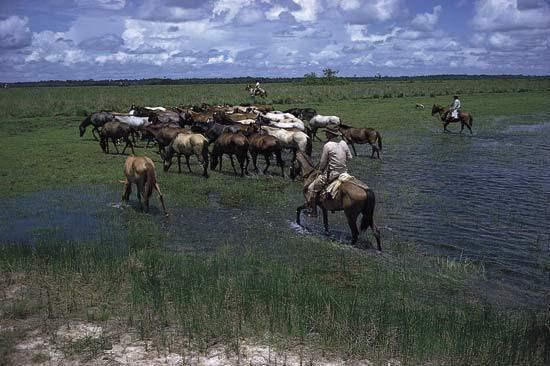
The flooding also made the area unfit for most agriculture before the advent of modern, industrial farming technology. Therefore, during the Spanish colonial era, the primary economic activity of the area was the herding of millions of heads of cattle. An 1856 watercolor by Manuel María Paz depicts sparsely populated open grazing lands with cattle and palm trees. The term llanero ("plainsman") became synonymous with the cowhands that took care of the herds, and had some cultural similarities with the gauchos of the Pampas or the vaqueros of Spanish and Mexican Texas.
The rivers and marshes of Los Llanos, Venezuela.
In the wet season most of the Llanos is flooded and travel is by boat down the numerous temporary and permanent waterways.
Oil and gas
In Los Llanos the governments of Venezuela and Colombia had developed a strong oil and gas industry in zones of Arauca, Casanare, Guárico, Anzoátegui, Apure and Monagas. The Orinoco Belt, entirely in Venezuelan territory, consists of large deposits of extra heavy crude (oil sands). The Orinoco belt oil sands are known to be one of the largest, behind that of the Athabasca Oil Sands in Alberta, Canada. Venezuela's non-conventional oil deposits of about 1,200 billion barrels (1.9×10¹¹ m3), found primarily in the Orinoco oil sands, are estimated to approximately equal the world's reserves of conventional oil.