
Country United States FIPS code 02-45020 | ||
 | ||
Area 155 ha (129 ha Land / 21 ha Water) | ||
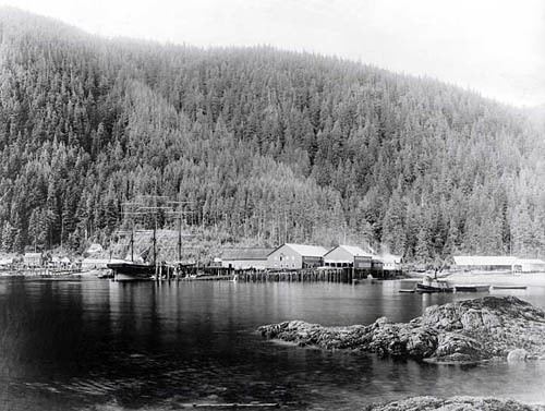
Loring The official website for the community is www.loringalaska.info www.loringalaska.info created in 2000 to share history,community and area information. Loring was established in 1885 with the first post office in the District of Alaska and is a census-designated place (CDP) in Ketchikan Gateway Borough in the U.S. state of Alaska. The population was 4 at the 2010 census.Though this varies with the season when the population is around 50 in the summer months.
Contents
Map of Loring, AK 99901, USA
Located due north of downtown Ketchikan on Revillagigedo Island, Loring was once Ketchikan's rival as the service center for the area's fishing and timber industries.
Geography
Loring is located at 55°36′11″N 131°38′13″W, on the western shore of Revillagigedo Island, approximately 15 miles (24 km) north of Ketchikan as the crow flies. It is located on the northern shore of Naha Bay, an arm of Behm Canal.
According to the United States Census Bureau, the CDP has a total area of 0.62 square miles (1.6 km2), of which 0.54 square miles (1.4 km2) is land and 0.077 square miles (0.2 km2), or 12.27%, is water.