
Unitary authority Postcode district SO16 Dialling code 023 Post town Southampton | Sovereign state United Kingdom | |
 | ||
Lordswood southampton mtb gopro
Lordswood is a district in Southampton, England. It is situated in the northern part of the city bordering the areas of Lordshill, Chilworth, Aldermoor and Bassett.
Contents
- Lordswood southampton mtb gopro
- Map of Lordswood Southampton UK
- History of Lordswood
- Landscape
- Housing
- Transport
- References
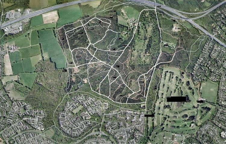
Map of Lordswood, Southampton, UK
History of Lordswood
According to the Anglo-Saxon Charter of 956 Aldermoor Lordswood, Lordshill and Coxford are all within the ancient boundary of the Manor of Millbrook and were farmland within the county of Hampshire, until the 20th Century when it was absorbed into Southampton.
Landscape
The main feature is the gentle valley carved by Holly Brook. It is quite high ground in relation to sea level (45m) at the top of Hollybrook Cemetery.
Housing
The type of housing found in Lordswood is fairly large, owner-occupied detached residences such as Bassett Avenue. There is, however, a small area of fairly new council flats in the Dunkirk Road area.
Transport
The A35 Winchester Road, Southampton Ring Road is in the south-east corner. Lordswood Road is a throughroute from the northern suburbs to the West. Lord's Hill Way is a distributor road for the Lord's Hill estate, built in the 1970s.