
Country United States FIPS code 38-48020 Area 65 ha Zip code 58761 Population 9 (2013) | Time zone Central (CST) (UTC-6) GNIS feature ID 1030017 Elevation 497 m Local time Sunday 7:49 PM Area code 701 | |
 | ||
Weather -15°C, Wind NE at 18 km/h, 80% Humidity | ||
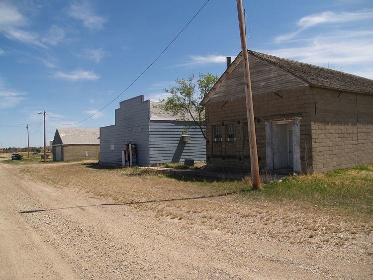
Loraine is a city in Renville County, North Dakota, United States. The population was nine at the 2010 census. It is part of the Minot Micropolitan Statistical Area.
Contents
Map of Loraine, ND 58761, USA
Loraine was founded in 1907 and is said to have been named by Mohall banker Sherwood H. Sleeper (namesake of Sherwood) for Fort La Reine, one of the forts of the exploration directed by Pierre Gaultier de Varennes, sieur de La Vérendrye in the 18th century.
Geography
Loraine is located at 48°52′2″N 101°34′10″W (48.867126, -101.569387).
According to the United States Census Bureau, the city has a total area of 0.25 square miles (0.65 km2), all of it land.
2010 census
As of the census of 2010, there were 9 people, 4 households, and 2 families residing in the city. The population density was 36.0 inhabitants per square mile (13.9/km2). There were 7 housing units at an average density of 28.0 per square mile (10.8/km2). The racial makeup of the city was 100.0% White.
There were 4 households of which 25.0% had children under the age of 18 living with them, 50.0% were married couples living together, and 50.0% were non-families. 50.0% of all households were made up of individuals. The average household size was 2.25 and the average family size was 3.50.
The median age in the city was 49.3 years. 22.2% of residents were under the age of 18; 11.1% were between the ages of 18 and 24; 11.1% were from 25 to 44; 55.5% were from 45 to 64; and 0.0% were 65 years of age or older. The gender makeup of the city was 66.7% male and 33.3% female.
2000 census
As of the census of 2000, there were 19 people, 8 households, and 5 families residing in the city. The population density was 78.7 people per square mile (30.6/km²). There were 8 housing units at an average density of 33.1 per square mile (12.9/km²). The racial makeup of the city was 100.00% White.
There were 8 households out of which 37.5% had children under the age of 18 living with them, 62.5% were married couples living together, and 37.5% were non-families. 37.5% of all households were made up of individuals and 25.0% had someone living alone who was 65 years of age or older. The average household size was 2.38 and the average family size was 3.20.
In the city, the population was spread out with 31.6% under the age of 18, 21.1% from 25 to 44, 26.3% from 45 to 64, and 21.1% who were 65 years of age or older. The median age was 44 years. For every 100 females there were 111.1 males. For every 100 females age 18 and over, there were 116.7 males.
The median income for a household in the city was $36,250, and the median income for a family was $36,250. Males had a median income of $0 versus $16,250 for females. The per capita income for the city was $7,810. There are 25.0% of families living below the poverty line and 13.3% of the population, including no under eighteens and none of those over 64.