
 | ||
Lopushnia, Lopushnya, sometimes Lopushna (Ukrainian: Лопушня, Polish: Lopuszna, Lopusznia) - is a village of 282 people in Rohatyn Raion of Ivano-Frankivsk Oblast in western part of Ukraine. It is the first village on the highway when entering Rohatyn raion and Ivano-Frankivsk Oblast from the side of Berezhany and Ternopil Oblast. The river Narayivka flows through Lopushnia.
Contents
- Map of Lopushnya Ivano Frankivska Ukraine
- From the history
- Village data
- Neighbouring localities
- References
Map of Lopushnya, Ivano-Frankivska, Ukraine
In terms of administration the village is subordinated to the village council in Verkhnia Lypytsia, much larger neighbouring village 2 km away.
There are daily bus connections between Lopushnia and Rohatyn, as well as between Lopushnia and Berezhany. The village is easily accessible by road and public transport.
There are vast deposits of limestone in the hills. Limestone is being mined and slaked here.
The closest railway station is in Pidvysoke, less than 1 km away.
From the history
An idol of ancient Slavic deity of Swietowit was found at Lopushnia.
In 1772-1918 Lopushnia was part of Austrian empire. In 1918 - 1919 of West Ukrainian People's Republic. In 1920 - 1939 of Poland.
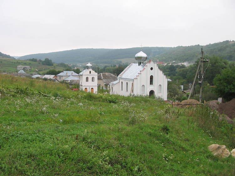
During the First World War there was a front line in Lopushnia and the surrounding areas. As result there are numerous trenches and bomb holes in the local forests since those times. There is also First World War Turkish Military Cemetery and Memorial to the fallen Turkish soldiers here. There is also Austrian Military Cemetery, in desolate condition.
There is a significant community of deported Ukrainians from south east Poland (Lemkovyna and Nadsannia / Upper San valley) residing in Lopushnia. They have been forcefully resettled here during "Action Vistula" in late 1940s. A monument commemorating this tragic event (with the names of deportees and their original villages) has been erected next to the new church in Lopushnia.