
Demonym(s) Longianesi Postal code 47020 | Elevation 169 m (554 ft) Time zone CET (UTC+1) Local time Sunday 8:18 PM | |
 | ||
Frazioni Capoluogo, Budrio, Ponte Ospedaletto, Crocetta, Montilgallo, Felloniche, Badia, Massa Weather 9°C, Wind SE at 13 km/h, 75% Humidity | ||
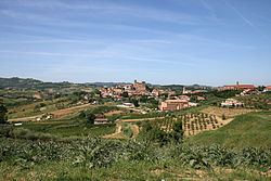
Longiano is a comune (municipality) in the Province of Forlì-Cesena in the Italian region Emilia-Romagna, located about 90 kilometres (56 mi) southeast of Bologna and about 30 kilometres (19 mi) southeast of Forlì. Longiano borders the following municipalities: Borghi, Cesena, Gambettola, Gatteo, Montiano, Roncofreddo, Santarcangelo di Romagna, Savignano sul Rubicone.
Contents
Map of 47020 Longiano, Province of Forl%C3%AC-Cesena, Italy
Main sights
References
Longiano Wikipedia(Text) CC BY-SA