
Prominence 120 ft (37 m) Topo map USGS Mindego Hill | ||
 | ||
Elevation 2603+ ft (793+ m) NAVD 88 Similar Mount Bielawski, Mount Thayer, Santa Cruz Mountains, Black Mountain, Tip Toe Falls | ||
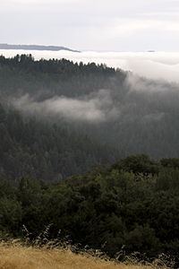
Long Ridge is a hill located in the Santa Cruz Mountains in the San Francisco Bay Area, California. The hill rises to an elevation of about 2,600 feet (792 m) on private property near Highway 35 and the Santa Clara-San Mateo county line. The hill is the highest point in San Mateo County. A hill to the northeast of Long Ridge rises to 2,566 feet (782 m). Some snow falls on the mountain during the winter.
Map of Long Ridge, California 94020, USA
The Long Ridge Open Space Preserve is named for this ridge.
References
Long Ridge (San Mateo County, California) Wikipedia(Text) CC BY-SA