
Country United States County Ocean Elevation 0 ft (0 m) Zip code 08008 Population 3,329 (2000) | Incorporated March 23, 1899 Area 57.07 km² Local time Sunday 11:01 AM | |
 | ||
Area rank 125th of 566 in state13th of 33 in county Weather -2°C, Wind NW at 21 km/h, 39% Humidity | ||
Long Beach Township is a Walsh Act Township in Ocean County, New Jersey, United States. As of the 2010 United States Census, the township's population was 3,051 reflecting a decline of 278 (-8.4%) from the 3,329 counted in the 2000 Census, which had in turn declined by 78 (-2.3%) from the 3,407 counted in the 1990 Census.
Contents
- Map of Long Beach Township NJ USA
- Geography
- Census 2010
- Census 2000
- Local government
- Federal state and county representation
- Politics
- Education
- Roads and highways
- Public transportation
- References
Map of Long Beach Township, NJ, USA
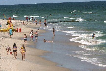
The township is located on Long Beach Island, a barrier island along the Atlantic Ocean whose summer population swells to as much as 130,000, including part-time residents and tourists. In October 2012, Long Beach Township was severely affected by Hurricane Sandy, with township mayor Joe Mancini estimating that potential costs to repair the damage estimated as high as $1 billion across Long Beach Island. As a result of the storm surge, flooding and high winds, dozens of homes and businesses were damaged or destroyed. After the waters receded, streets were left covered with up to four feet of sand in some spots. Governor Chris Christie issued a mandatory evacuation order on October 28, and it remained in place until a full 13 days after the storm. The township established a Sandy Relief Fund to assist residents in their recovery from the hurricane.
Long Beach Township was incorporated as a township by an act of the New Jersey Legislature on March 23, 1899, from portions of Eagleswood Township, Little Egg Harbor Township, Ocean Township, Stafford Township and Union Township (now known as Barnegat Township). Portions of the township were taken to form Barnegat City (March 29, 1904, now Barnegat Light) and Ship Bottom-Beach Arlington (March 3, 1925, now Ship Bottom). The name derives from the length of the island along Barnegat Bay.
Geography
According to the United States Census Bureau, Long Beach township had a total area of 22.036 square miles (57.073 km2), including 5.444 square miles (14.099 km2) of land and 16.592 square miles (42.974 km2) of water (75.30%).
North Beach Haven (with a 2010 Census population of 2,235) is an unincorporated community and census-designated place (CDP) located within Long Beach Township. Other unincorporated communities, localities and place names located partially or completely within the township include the Long Beach Island communities of Bay Vista, Beach Haven Crest, Beach Haven Gardens, Beach Haven Heights, Beach Haven Inlet, Beach Haven Park, Beach Haven Terrace, Brant Beach, Brighton Beach, Haven Beach, High Bar Harbor, Holgate, Loveladies, North Beach, North Beach Haven, Peahala Park, South Beach Haven, Spray Beach, and the Dunes.
The township is divided into four discontiguous land areas. The most populous, with most of the named places, is located north of Beach Haven and south of Ship Bottom. The Holgate section is south of Beach Haven; most of it is a wildlife preserve. Loveladies and High Bar Harbor form the northernmost, between Harvey Cedars and Barnegat Light. North Beach and Frazier Park north of Surf City and south of Harvey Cedars.
The township borders the Ocean County municipalities of Barnegat Light, Barnegat Township, Beach Haven, Eagleswood Township, Harvey Cedars, Little Egg Harbor Township, Ocean Township, Ship Bottom, Stafford Township and Surf City.
Census 2010
The 2010 United States Census counted 3,051 people, 1,539 households, and 943.4 families residing in the township. The population density was 560.5 per square mile (216.4/km2). The township contained 9,216 housing units at an average density of 1,693.0 per square mile (653.7/km2). The racial makeup of the township was 96.98% (2,959) White, 0.26% (8) Black or African American, 0.03% (1) Native American, 0.49% (15) Asian, 0.00% (0) Pacific Islander, 1.57% (48) from other races, and 0.66% (20) from two or more races. Hispanics or Latinos of any race were 4.13% (126) of the population.
Out of a total of 1,539 households, 9.6% had children under the age of 18 living with them, 53.9% were married couples living together, 4.7% had a female householder with no husband present, and 38.7% were non-families. 34.8% of all households were made up of individuals, and 19.4% had someone living alone who was 65 years of age or older. The average household size was 1.98 and the average family size was 2.48.
In the township, 9.9% of the population were under the age of 18, 3.9% from 18 to 24, 12.7% from 25 to 44, 33.4% from 45 to 64, and 40.1% who were 65 years of age or older. The median age was 61.3 years. For every 100 females the census counted 96.6 males, but for 100 females at least 18 years old, it was 97.3 males.
The Census Bureau's 2006-2010 American Community Survey showed that (in 2010 inflation-adjusted dollars) median household income was $77,396 (with a margin of error of +/- $15,929) and the median family income was $95,417 (+/- $12,507). Males had a median income of $69,922 (+/- $25,066) versus $59,688 (+/- $18,587) for females. The per capita income for the borough was $63,020 (+/- $9,706). About 2.3% of families and 3.5% of the population were below the poverty line, including 0.0% of those under age 18 and 7.1% of those age 65 or over.
Census 2000
As of the 2000 United States Census there were 3,329 people, 1,664 households, and 1,038 families residing in the township. The population density was 627.3 people per square mile (242.1/km²). There were 9,023 housing units at an average density of 1,700.1 per square mile (656.1/km²). The racial makeup of the township was 98.53% White, 0.24% African American, 0.03% Native American, 0.36% Asian, 0.33% from other races, and 0.51% from two or more races. Hispanic or Latino of any race were 2.10% of the population.
There were 1,664 households out of which 12.3% had children under the age of 18 living with them, 53.5% were married couples living together, 6.4% had a female householder with no husband present, and 37.6% were non-families. 33.8% of all households were made up of individuals and 19.9% had someone living alone who was 65 years of age or older. The average household size was 2.00 and the average family size was 2.50.
In the township the population was spread out with 11.7% under the age of 18, 3.9% from 18 to 24, 17.9% from 25 to 44, 30.0% from 45 to 64, and 36.5% who were 65 years of age or older. The median age was 57 years. For every 100 females there were 90.2 males. For every 100 females age 18 and over, there were 89.2 males.
The median income for a household in the township was $48,697, and the median income for a family was $59,833. Males had a median income of $41,681 versus $31,528 for females. The per capita income for the township was $33,404. About 3.8% of families and 5.1% of the population were below the poverty line, including 7.6% of those under age 18 and 5.8% of those age 65 or over.
Local government
Long Beach Township has been governed under the Walsh Act form of New Jersey municipal government, by a three-member Township Committee, since 1936. Commissioners are elected to serve four-year terms on a concurrent basis in nonpartisan elections, with all current commissioner's terms of office ending on December 31, 2016. The Board of Commissioners passed an ordinance in February 2011 shifting the nonpartisan elections from May to November, beginning as of the November 2012 election.
As of 2016, the members of the Long Beach Township Board of Commissioners are Mayor Joseph H. Mancini (Commissioner of Public Affairs and Public Safety), Ralph H. Bayard (Commissioner of Public Works, Parks and Public Property) and Dr. Joseph P. Lattanzi (Commissioner of Revenue and Finance), all serving terms of office that end December 31, 2016.
On August 12, 2009, Commissioner DiAnne Gove was selected by Republican county committee members to fill the remainder of the term of Daniel Van Pelt in the General Assembly representing the 9th legislative district after Van Pelt had resigned after being arrested on corruption charges.
Federal, state and county representation
Long Beach Township is located in the 2nd Congressional District and is part of New Jersey's 9th state legislative district. Prior to the 2010 Census, Long Beach Township had been part of the 3rd Congressional District, a change made by the New Jersey Redistricting Commission that took effect in January 2013, based on the results of the November 2012 general elections.
New Jersey's Second Congressional District is represented by Frank LoBiondo (R, Ventnor City). New Jersey is represented in the United States Senate by Cory Booker (D, Newark, term ends 2021) and Bob Menendez (D, Paramus, 2019).
For the 2016–2017 session (Senate, General Assembly), the 9th Legislative District of the New Jersey Legislature is represented in the State Senate by Christopher J. Connors (R, Lacey Township) and in the General Assembly by DiAnne Gove (R, Long Beach Township) and Brian E. Rumpf (R, Little Egg Harbor Township). The Governor of New Jersey is Chris Christie (R, Mendham Township). The Lieutenant Governor of New Jersey is Kim Guadagno (R, Monmouth Beach).
Ocean County is governed by a Board of Chosen Freeholders consisting of five members, elected on an at-large basis in partisan elections and serving staggered three-year terms of office, with either one or two seats coming up for election each year as part of the November general election. At an annual reorganization held in the beginning of January, the board chooses a Director and a Deputy Director from among its members. As of 2015, Ocean County's Freeholders (with party affiliation, term-end year, residence and department directorship listed in parentheses) are Freeholder Director John C. Bartlett, Jr. (R, term ends December 31, 2015, Pine Beach; Finance, Parks and Recreation), Freeholder Deputy Director Gerry P. Little (R, 2015, Surf City; Human Services), John P. Kelly (R, 2016, Eagleswood Township; Law and Public Safety), James F. Lacey (R, 2016, Brick Township; Transportation) and Joseph H. Vicari (R, 2017, Toms River; Senior Services and County Operations). Constitutional officers elected on a countywide basis are County Clerk Scott M. Colabella (R, 2015, Barnegat Light), Sheriff Michael Mastronardy (R, 2016; Toms River) and Surrogate Jeffrey Moran (R, 2018, Beachwood).
Politics
As of March 23, 2011, there were a total of 2,955 registered voters in Long Beach Township, of which 544 (18.4%) were registered as Democrats, 1,215 (41.1%) were registered as Republicans and 1,195 (40.4%) were registered as Unaffiliated. There was one voter registered to another party. Among the township's 2010 Census population, 96.9% (vs. 63.2% in Ocean County) were registered to vote, including 107.5% of those ages 18 and over (vs. 82.6% countywide).
In the 2012 presidential election, Republican Mitt Romney received 64.3% of the vote (1,166 cast), ahead of Democrat Barack Obama with 34.8% (632 votes), and other candidates with 0.9% (16 votes), among the 1,844 ballots cast by the township's 3,027 registered voters (30 ballots were spoiled), for a turnout of 60.9%. In the 2008 presidential election, Republican John McCain received 61.3% of the vote (1,441 cast), ahead of Democrat Barack Obama with 36.8% (865 votes) and other candidates with 1.1% (26 votes), among the 2,351 ballots cast by the township's 3,132 registered voters, for a turnout of 75.1%. In the 2004 presidential election, Republican George W. Bush received 63.1% of the vote (1,499 ballots cast), outpolling Democrat John Kerry with 35.6% (847 votes) and other candidates with 0.6% (20 votes), among the 2,377 ballots cast by the township's 3,128 registered voters, for a turnout percentage of 76.0.
In the 2013 gubernatorial election, Republican Chris Christie received 81.4% of the vote (1,267 cast), ahead of Democrat Barbara Buono with 17.7% (275 votes), and other candidates with 1.0% (15 votes), among the 1,570 ballots cast by the township's 2,960 registered voters (13 ballots were spoiled), for a turnout of 53.0%. In the 2009 gubernatorial election, Republican Chris Christie received 63.7% of the vote (1,167 ballots cast), ahead of Democrat Jon Corzine with 27.9% (512 votes), Independent Chris Daggett with 6.6% (121 votes) and other candidates with 0.8% (14 votes), among the 1,833 ballots cast by the township's 3,041 registered voters, yielding a 60.3% turnout.
Education
For Kindergarten through sixth grade, public school students attend the Long Beach Island Consolidated School District, which serves students from Barnegat Light, Harvey Cedars, Long Beach Township, Ship Bottom and Surf City. As of the 2014-15 school year, the district and its two schools had an enrollment of 456 students and 28.3 classroom teachers (on an FTE basis), for a student–teacher ratio of 16.1:1. Schools in the district (with 2014-15 enrollment data from the National Center for Education Statistics) are Ethel Jacobsen School in Surf City with 110 students in pre-kindergarten to second grade and Long Beach Island Grade School in Ship Bottom with 122 students in grades 3 – 6,
Students in public school for seventh through twelfth grades attend the Southern Regional School District, which serves the five municipalities in the Long Beach Island Consolidated School District, along with students from Beach Haven and Stafford Township, as well as students from Ocean Township (including its Waretown section) who attend as part of a sending/receiving relationship. Schools in the district (with 2014-15 enrollment data from the National Center for Education Statistics) are Southern Regional Middle School (grades 7 and 8; 937 students) and Southern Regional High School (grades 9 – 12; 2,064 students). Both schools are in the Manahawkin section of Stafford Township.
At the time of its founding in 1957, the Southern Regional School District had a roughly equal number of students from Long Beach Island and Stafford Township. By 2016, the overwhelming majority of students were from Stafford Township, accounting for nearly 90% of enrollment. These demographic changes have led to significant discrepancies in the cost per pupil sent to the district from each community, with Harvey Cedars and Long Beach Township paying more than $200,000 per pupil, while Stafford Township's costs are $3,600 for each student. These widely different costs result from a formula that uses the taxable property value in each municipality to apportion costs, which means that municipalities with relatively high property values and small numbers of students pay a higher share of total district costs. Some residents of Long Beach Island communities are seeking to amend the formula to take advantage of a 1993 law that allows districts to use both property value and enrollment to allocate property taxes, though that would require passage of referendums in each municipality.
Roads and highways
As of May 2010, the township had a total of 66.33 miles (106.75 km) of roadways, of which 54.41 miles (87.56 km) were maintained by the municipality and 11.92 miles (19.18 km) by Ocean County.
Public transportation
Ocean Ride local service is provided on the OC9 LBI North / South route.
The LBI Shuttle operates along Long Beach Boulevard, providing free service every 5 to 20 minutes from 10:00 AM to 10:00 PM. It serves the Long Beach Island municipalities / communities of Barnegat Light, Loveladies, Harvey Cedars, North Beach, Surf City, Ship Bottom, Long Beach Township, Beach Haven and Holgate.