
Country United States County Ocean Time zone Eastern (EST) (UTC-5) Area 3.069 km² Population 343 (2013) Area code 609 | Incorporated November 20, 1894 Elevation 90 cm Zip code 08008 Local time Friday 12:14 PM | |
 | ||
Area rank 486th of 566 in state21st of 33 in county Weather 6°C, Wind NW at 26 km/h, 27% Humidity | ||
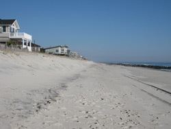
Harvey Cedars is a borough in Ocean County, New Jersey, United States. As of the 2010 United States Census, the borough's population was 337, reflecting a decline of 22 (-6.1%) from the 359 counted in the 2000 Census, which had in turn declined by 3 (-0.8%) from the 362 counted in the 1990 Census. The borough borders the Atlantic Ocean on Long Beach Island.
Contents
- Map of Harvey Cedars NJ 08008 USA
- History
- Geography
- Census 2010
- Census 2000
- Local government
- Federal state and county representation
- Politics
- Education
- Roads and highways
- Public transportation
- Noted residents
- References
Map of Harvey Cedars, NJ 08008, USA
Harvey Cedars was incorporated as a borough by an act of the New Jersey Legislature on December 15, 1894, from portions of Union Township (now Barnegat Township), based on the results of a referendum held on November 20, 1894.
The majority of the housing units in the borough are seasonal houses used primarily in the summer by owners who live elsewhere, bringing the summer population to 12,000. The borough's quiet character and bay and ocean access make housing very expensive, with bay or oceanfront houses priced at $2 million or more. Despite the borough's small size, its property was assessed at over $1.2 billion in 2014.
History
Before Long Beach Island was developed, its northern area, from the Barnegat Inlet to the Great Swamp (now Surf City), was covered with Atlantic white cedar (chamaecyparis thyoides). Early inhabitants of the area harvested salt hay (spartina patens) and seaweed to make a living.
The earliest reference to the area was a deed from 1751 that called the place "Harvest Quarters". The name "Harvey Cedars" may be a portmanteau derived from the combination of "harvest" housing used by these farmers and the "cedars" that grew in the area.
Geography
According to the United States Census Bureau, the borough had a total area of 1.185 square miles (3.070 km2), including 0.557 square miles (1.444 km2) of land and 0.628 square miles (1.626 km2) of water (52.97%).
Unincorporated communities, localities and place names located partially or completely within the borough include High Point.
The borough borders the Ocean County municipalities of Barnegat Township, Long Beach Township and Stafford Township.
Census 2010
The 2010 United States Census counted 337 people, 169 households, and 110 families residing in the borough. The population density was 604.6 per square mile (233.4/km2). The borough contained 1,214 housing units at an average density of 2,178.0 per square mile (840.9/km2). The racial makeup of the borough was 99.11% (334) White, 0.59% (2) Black or African American, 0.00% (0) Native American, 0.30% (1) Asian, 0.00% (0) Pacific Islander, 0.00% (0) from other races, and 0.00% (0) from two or more races. Hispanics or Latinos of any race were 0.89% (3) of the population.
Out of a total of 169 households, 13.6% had children under the age of 18 living with them, 59.8% were married couples living together, 5.3% had a female householder with no husband present, and 34.9% were non-families. 32.0% of all households were made up of individuals, and 18.3% had someone living alone who was 65 years of age or older. The average household size was 1.99 and the average family size was 2.47.
In the borough, 11.6% of the population were under the age of 18, 4.5% from 18 to 24, 10.1% from 25 to 44, 32.0% from 45 to 64, and 41.8% who were 65 years of age or older. The median age was 61.6 years. For every 100 females the census counted 97.1 males, but for 100 females at least 18 years old, it was 97.4 males.
The Census Bureau's 2006-2010 American Community Survey showed that (in 2010 inflation-adjusted dollars) median household income was $106,875 (with a margin of error of +/- $15,693) and the median family income was $112,656 (+/- $8,889). Males had a median income of $85,625 (+/- $32,732) versus $51,875 (+/- $42,840) for females. The per capita income for the borough was $74,525 (+/- $13,683). About 3.0% of families and 4.2% of the population were below the poverty line, including 0.0% of those under age 18 and 6.2% of those age 65 or over.
Census 2000
As of the 2000 United States Census there were 359 people, 167 households, and 112 families residing in the borough. The population density was 657.1 people per square mile (252.0/km2). There were 1,205 housing units at an average density of 2,205.6 per square mile (845.9/km2). The racial makeup of the borough was 96.94% White, 0.56% African American, 0.28% Native American, 0.28% Asian, 1.95% from other races. Hispanic or Latino of any race were 3.62% of the population.
There were 167 households out of which 16.8% had children under the age of 18 living with them, 61.7% were married couples living together, 4.2% had a female householder with no husband present, and 32.9% were non-families. 29.3% of all households were made up of individuals and 15.6% had someone living alone who was 65 years of age or older. The average household size was 2.15 and the average family size was 2.61.
In the borough the population was spread out with 14.5% under the age of 18, 4.2% from 18 to 24, 22.0% from 25 to 44, 29.0% from 45 to 64, and 30.4% who were 65 years of age or older. The median age was 54 years. For every 100 females there were 102.8 males. For every 100 females age 18 and over, there were 106.0 males.
The median income for a household in the borough was $61,875, and the median income for a family was $69,722. Males had a median income of $71,042 versus $32,361 for females. The per capita income for the borough was $36,757. About 2.6% of families and 5.1% of the population were below the poverty line, including 5.1% of those under age 18 and 2.9% of those age 65 or over.
Local government
The Borough of Harvey Cedars has operated under the Walsh Act Commission form of New Jersey municipal government since 1923. The governing body is a three-member Board of Commissioners whose members are elected at-large on a nonpartisan basis to serve conncurrent four-year terms of office in elections held as part of the November general election. Each commissioner acts as department head. The Mayor and Deputy Mayor are elected by the Board from among its members. The mayor has no veto power.
As of 2016, members of the Harvey Cedars Board of Commissioners are Mayor Jonathan S. Oldham (Commissioner of Public Works, Parks and Public Property), Deputy mayor Judith E. Gerkens (Commissioner of Revenue and Finance) and Michael E. Garofalo (Commissioner of Public Affairs and Public Safety), all of whom are serving concurrent four-year terms of office that expire on December 31, 2019.
Federal, state and county representation
Harvey Cedars is located in the 2nd Congressional District and is part of New Jersey's 9th state legislative district. Prior to the 2010 Census, Harvey Cedars had been part of the 3rd Congressional District, a change made by the New Jersey Redistricting Commission that took effect in January 2013, based on the results of the November 2012 general elections.
New Jersey's Second Congressional District is represented by Frank LoBiondo (R, Ventnor City). New Jersey is represented in the United States Senate by Cory Booker (D, Newark, term ends 2021) and Bob Menendez (D, Paramus, 2019).
For the 2016–2017 session (Senate, General Assembly), the 9th Legislative District of the New Jersey Legislature is represented in the State Senate by Christopher J. Connors (R, Lacey Township) and in the General Assembly by DiAnne Gove (R, Long Beach Township) and Brian E. Rumpf (R, Little Egg Harbor Township). The Governor of New Jersey is Chris Christie (R, Mendham Township). The Lieutenant Governor of New Jersey is Kim Guadagno (R, Monmouth Beach).
Ocean County is governed by a Board of Chosen Freeholders consisting of five members, elected on an at-large basis in partisan elections and serving staggered three-year terms of office, with either one or two seats coming up for election each year as part of the November general election. At an annual reorganization held in the beginning of January, the board chooses a Director and a Deputy Director from among its members. As of 2015, Ocean County's Freeholders (with party affiliation, term-end year, residence and department directorship listed in parentheses) are Freeholder Director John C. Bartlett, Jr. (R, term ends December 31, 2015, Pine Beach; Finance, Parks and Recreation), Freeholder Deputy Director Gerry P. Little (R, 2015, Surf City; Human Services), John P. Kelly (R, 2016, Eagleswood Township; Law and Public Safety), James F. Lacey (R, 2016, Brick Township; Transportation) and Joseph H. Vicari (R, 2017, Toms River; Senior Services and County Operations). Constitutional officers elected on a countywide basis are County Clerk Scott M. Colabella (R, 2015, Barnegat Light), Sheriff Michael Mastronardy (R, 2016; Toms River) and Surrogate Jeffrey Moran (R, 2018, Beachwood).
Politics
As of March 23, 2011, there were a total of 375 registered voters in Harvey Cedars, of which 86 (22.9%) were registered as Democrats, 157 (41.9%) were registered as Republicans and 132 (35.2%) were registered as Unaffiliated. There were no voters registered to other parties. Among the borough's 2010 Census population, 111.3% (vs. 63.2% in Ocean County) were registered to vote, including 125.8% of those ages 18 and over (vs. 82.6% countywide).
In the 2012 presidential election, Republican Mitt Romney received 58.7% of the vote (152 cast), ahead of Democrat Barack Obama with 40.5% (105 votes), and other candidates with 0.8% (2 votes), among the 262 ballots cast by the borough's 412 registered voters (3 ballots were spoiled), for a turnout of 63.6%. In the 2008 presidential election, Republican John McCain received 54.5% of the vote (145 cast), ahead of Democrat Barack Obama with 42.5% (113 votes) and other candidates with 1.1% (3 votes), among the 266 ballots cast by the borough's 384 registered voters, for a turnout of 69.3%. In the 2004 presidential election, Republican George W. Bush received 60.1% of the vote (181 ballots cast), outpolling Democrat John Kerry with 39.5% (119 votes) and other candidates with 0.3% (1 votes), among the 301 ballots cast by the borough's 388 registered voters, for a turnout percentage of 77.6.
In the 2013 gubernatorial election, Republican Chris Christie received 73.6% of the vote (159 cast), ahead of Democrat Barbara Buono with 25.0% (54 votes), and other candidates with 1.4% (3 votes), among the 221 ballots cast by the borough's 423 registered voters (5 ballots were spoiled), for a turnout of 52.2%. In the 2009 gubernatorial election, Republican Chris Christie received 56.8% of the vote (126 ballots cast), ahead of Democrat Jon Corzine with 35.1% (78 votes), Independent Chris Daggett with 5.9% (13 votes) and other candidates with 0.5% (1 votes), among the 222 ballots cast by the borough's 355 registered voters, yielding a 62.5% turnout.
Education
For kindergarten through sixth grade, public school students attend the Long Beach Island Consolidated School District, which also serves students from Barnegat Light, Long Beach Township, Ship Bottom and Surf City. As of the 2014-15 school year, the district and its two schools had an enrollment of 456 students and 28.3 classroom teachers (on an FTE basis), for a student–teacher ratio of 16.1:1. Schools in the district (with 2014-15 enrollment data from the National Center for Education Statistics) are Ethel Jacobsen School in Surf City with 110 students in pre-kindergarten to second grade and Long Beach Island Grade School in Ship Bottom with 122 students in grades 3 – 6,
Students in public school for seventh through twelfth grades attend the Southern Regional School District, which serves the five municipalities in the Long Beach Island Consolidated School District, along with students from Beach Haven and Stafford Township, as well as students from Ocean Township (including its Waretown section) who attend as part of a sending/receiving relationship. Schools in the district (with 2014-15 enrollment data from the National Center for Education Statistics) are Southern Regional Middle School (grades 7 and 8; 937 students) and Southern Regional High School (grades 9 – 12; 2,064 students). Both schools are in the Manahawkin section of Stafford Township.
At the time of its founding in 1957, the Southern Regional School District had a roughly equal number of students from Long Beach Island and Stafford Township. By 2016, the overwhelming majority of students were from Stafford Township, accounting for nearly 90% of enrollment. These demographic changes have led to significant discrepancies in the cost per pupil sent to the district from each community, with Harvey Cedars and Long Beach Township paying more than $200,000 per pupil, while Stafford Township's costs are $3,600 for each student. These widely different costs result from a formula that uses the taxable property value in each municipality to apportion costs, which means that municipalities with relatively high property values and small numbers of students pay a higher share of total district costs. Some residents of Long Beach Island communities are seeking to amend the formula to take advantage of a 1993 law that allows districts to use both property value and enrollment to allocate property taxes, though that would require passage of referendums in each municipality.
Roads and highways
As of May 2010, the borough had a total of 9.82 miles (15.80 km) of roadways, of which 7.59 miles (12.21 km) were maintained by the municipality and 2.23 miles (3.59 km) by Ocean County.
Public transportation
Ocean County Ride provides bus service on the OC9 LBI North route between Barnegat Light and Manahawkin / Stafford Township.
The LBI Shuttle operates along Long Beach Boulevard, providing free service every 5 to 20 minutes from 10:00 AM to 10:00 PM. It serves the Long Beach Island municipalities / communities of Barnegat Light, Loveladies, Harvey Cedars, North Beach, Surf City, Ship Bottom, Long Beach Township, Beach Haven and Holgate.
Noted residents
People who were born in, residents of, or otherwise closely associated with Harvey Cedars include: