
Prominence 893 ft (272 m) Topo map USGS Draper | Parent range Wasatch Range Mountain type Quartz monzonite | |
 | ||
Elevation 11,260 feet (3,432 m) NAVD 88 | ||
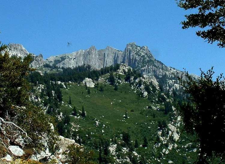
Lone Peak, a mountain peak southeast of Salt Lake City, Utah, United States is the center of the Lone Peak Wilderness, established in 1978. With an elevation of 11,260 feet (3,430 m), it is one of the taller peaks in the Wasatch Range along the Wasatch Front and tends to be a favorite hike. Lone Peak consists almost entirely of quartz monzonite (a granitoid, or granite-like) rock of the 30.5 million year old Little Cottonwood Stock. Quartzite and limestone are also found in distal locations on the mountain.
Contents
- HikingBackpacking
- Jacobs Ladder Trail
- Draper Ridge Trail
- Cherry Canyon Logging Trail
- Outlaw Cabin
- Deaths on Lone Peak
- Devils Brigade film
- References
Lone Peak ranks 98th on a list of Utah peaks with 500 feet (150 m) topographic prominence.
Hiking/Backpacking
It is possible to reach the summit in one long day, but rock climbers often camp at the base of the summit and non-climbers often camp lower on the Jacob's Ladder Trail. There are a few streams that dry up before summer, so water must be carried in. There is reputedly a spring that runs year-round.
Jacob's Ladder Trail
The trail head, located at 40°29′39″N 111°48′59″W, is marked with a sign. It is located near a large turnout on the right side of the road and three 4-wheel drive tracks climbing the road bank on the north side of the road. In 2007, the turnout was accompanied by a wooden fence leading to the starting point of the trail.
Draper Ridge Trail
The Draper Ridge Trail is currently inactive. The trail is in a deteriorated condition, as the top of the trail is very exposed to weather. Towards the bottom, thick undergrowth prevents passage. The Jacob's Ladder Trailhead is just up the road. The Jacob's Ladder Trail overlaps the Draper Ridge Trail for the last 2/3 of the way to the peak.
Cherry Canyon Logging Trail
Important features of this trail are that it has a year-round spring(cold springs) located at 40°30′58″N 111°47′35″W and a small cabin in a meadow. The route gains altitude in the beginning, going through a steep scrub oak section. After a few hours of hiking, things change as the trail levels off and veers north into the trees crossing the water of cold springs in bear canyon. The trail climbs out of the drainage on the north side into a new drainage, but stays generally below the ridge line. The trail eventually opens into a meadow with a small cabin in the large pine trees. The trail continues up above the cabin to the southeast and crosses over to the south into another drainage at a low point on the ridge. The southeast top of the new drainage meets up with the main granite drainage running roughly north-south which leads to the Lone Peak Cirque via stacked rock cairns. An alternate route is to roughly follow the stream bed up the drainage until the top of the ridge that runs roughly north-south above a granite drainage is reached.
Outlaw Cabin
The Outlaw Cabin, located at 40°31′12″N 111°46′53″W on the southwest side of a meadow, was constructed in the summer of 1960 by the Allen Brothers and Alan Summerhays. Construction was completed in 1967 prior to the area being designated as a wilderness area. The cabin has three cots, a pot belly stove, cabinets, and two small windows. It is built from trees downed in the area and the roof is lined with plastic and dirt/grass for insulation. All the materials besides the trees were hauled to the location by horseback. The cabin is partially hidden by large trees. In October 1997, a Draper family was caught in a blinding snow storm and took shelter in the cabin until they were rescued. There is a journal in the cabin that visitors can add their stories to.