
Country United States Area code(s) 802 Elevation 584 m Population 1,709 (2000) | Time zone Eastern (EST) (UTC-5) FIPS code 50-40225 Zip code 05148 Local time Sunday 9:36 AM | |
 | ||
Weather -15°C, Wind NW at 16 km/h, 44% Humidity | ||
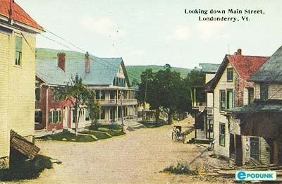
Londonderry is a town in Windham County, Vermont, United States. It is bounded on the north by Landgrove and Weston, on the east by Windham, on the south by Jamaica and on the west by Winhall and Landgrove. The population was 1,709 at the 2000 census. Londonderry also includes the village of South Londonderry.
Contents
Map of Londonderry, VT, USA
History
Londonderry was first chartered in 1770 to a Col. James Rogers and was known as Kent which then included what is now Windham. The town was again chartered by act of the new Vermont Legislature on April 20, 1780. In this charter the township was named Londonderry after Londonderry in New Hampshire. which in its turn was named after Londonderry now in Northern Ireland Derry / Londonderry Northern Ireland
Geography
According to the United States Census Bureau, the town has a total area of 35.9 square miles (92.9 km2), of which 35.7 square miles (92.4 km2) is land and 0.2 square mile (0.5 km2) (0.59%) is water. The West River flows through the town.
Climate
This climatic region is typified by large seasonal temperature differences, with warm to hot (and often humid) summers and cold (sometimes severely cold) winters. According to the Köppen Climate Classification system, Londonderry has a humid continental climate, abbreviated "Dfb" on climate maps.
Demographics
As of the census of 2000, there were 1,709 people, 730 households, and 470 families residing in the town. The population density was 47.9 people per square mile (18.5/km2). There were 1,317 housing units at an average density of 36.9 per square mile (14.3/km2). The racial makeup of the town was 98.60% White, 0.12% Black or African American, 0.23% American Indian or Alaska Native, 0.47% Asian, and 0.59% from two or more races. Hispanic or Latino of any race were 0.47% of the population.
There were 730 households out of which 27.7% had children under the age of 18 living with them, 53.3% were married couples living together, 8.1% had a female householder with no husband present, and 35.5% were non-families. 25.9% of all households were made up of individuals and 10.7% had someone living alone who was 65 years of age or older. The average household size was 2.34 and the average family size was 2.84.
In the town, the population was spread out with 21.9% under the age of 18, 6.0% from 18 to 24, 28.7% from 25 to 44, 26.9% from 45 to 64, and 16.6% who were 65 years of age or older. The median age was 42 years. For every 100 females there were 102.2 males. For every 100 females age 18 and over, there were 103.2 males.
The median income for a household in the town was $42,669, and the median income for a family was $48,000. Males had a median income of $29,871 versus $22,574 for females. The per capita income for the town was $24,220. About 2.7% of families and 6.3% of the population were below the poverty line, including 9.2% of those under age 18 and 6.7% of those age 65 or over.