Post town NORTHALLERTON Local time Sunday 1:36 PM Dialling code 01677 | Sovereign state United Kingdom Postcode district DL7 District Hambleton | |
 | ||
Weather 13°C, Wind W at 23 km/h, 67% Humidity Civil parish Exelby, Leeming and Newton | ||
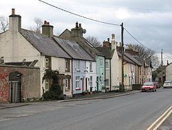
Londonderry is a village near the Yorkshire Dales, England situated 4 miles (6.4 km) south-east of Bedale, almost on the A1 road. It is part of the Hambleton district of North Yorkshire and is in the historic North Riding of Yorkshire.
Map of Londonderry, Northallerton, UK
It is named after the Londonderry family, who took their name from County Londonderry, Ireland, and were colliery owners in this area of England.
Londonderry Lodge was a former Transport Café in the village. The café is now closed, but served the traffic on the A1 road for 100 years. The building has been listed as Grade II since 1966. With the upgrading of the A1 to A1(M) standard, the junction with the A1 was diverted away from Londonderry (with even the new service road, the A6055, taking a route west of the new road as opposed to going through the hamlet). As a consequence of this, traffic has been lost from the hamlet, lorry traffic especially so. A noted refuelling service station have moved their business from Londonderry to Leeming Bar because of this traffic shift.
