
Legislature House of Commons District created 1966 Last contested 2015 Elector 91,601 | MP Kate Young
Liberal First contested 1968 District webpage profile, map Census divisions Middlesex County, London | |
 | ||
London west 2016 official post event video tough mudder
London West (French: London-Ouest) is a federal electoral district in London, Ontario, Canada, that has been represented in the House of Commons of Canada since 1968.
Contents
- London west 2016 official post event video tough mudder
- Geography
- History
- Demographics
- Members of Parliament
- References
Geography
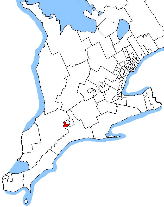
The district includes the northwest part of the City of London.
In 2003, it was defined to consist of the part of the city lying north and west of a line drawn from the western limit of the city along Dingman Creek, Southdale Road West, Wharncliffe Road South, Commissioners Road East, the Canadian National Railway, the Thames River, Wharncliffe Road North, Oxford Street West and Wonderland Road North.
History
The electoral district was created in 1966 from London, Middlesex East, and from Middlesex West.
It initially consisted of the part of the City of London west of a line drawn from north to south along Adelaide Street, Dundas Street, Wellington Street and Wellington Road.
In 1976, it was redefined to consist of the part of the city west of a line drawn from south to north along Southdale Road, Wellington Road, the Thames River and the North Thames River, Dundas Street, Colborne Street, Huron Street and Richmond Street.
In 1987, it was redefined to consist of the part of the city lying north and west of a line drawn from the southern limit of the city along Wharncliffe Road South, Commissioners Road East, Wellington Road, the Thames River, the North Thames River, the Medway River, Western Road and Richmond Street.
In 1996, it was redefined to consist of the part of the city lying north and west of a line drawn from the western limit of the city along Dingman Creek, Southdale Road West, Wharncliffe Road South, Commissioners Road East, the London and Port Stanley Electric Railway, the Thames River, Wharncliffe Road, Oxford Street, Wonderland Road North and Hutton Road.
In 2003, it was given its current boundaries as described above.
This riding lost territory to London North Centre during the 2012 electoral redistribution.
Demographics
According to the Canada 2011 CensusEthnic groups: 83.3% White, 2.9% Latin American, 2.4% Arab, 2.1% South Asian, 2.1% Black, 2.1% Chinese, 1.6% Aboriginal
Languages: 80.6% English, 2.8% Spanish, 2.2% Arabic, 1.7% French, 1.5% Chinese, 1.2% Polish
Religions: 65.4% Christian (27.1% Catholic, 11.1% United Church, 8.0% Anglican, 2.5% Baptist, 2.0% Christian Orthodox, 1.3% Lutheran), 4.5% Muslim, 27.8 No religion
Median income (2005): $29,322
Members of Parliament
This riding has elected the following Members of Parliament: