
Country Thailand Postal code 67110 Area 1,535 km² | Time zone ICT (UTC+7) Geocode 6703 Province Phetchabun Province | |
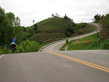 | ||
Direction lom sak to khao kho phetchabun
Lom Sak (Thai: หล่มสัก) is a district (amphoe) in the northern part of Phetchabun Province, northern Thailand.
Contents
- Direction lom sak to khao kho phetchabun
- Map of Lom Sak District Phetchabun Thailand
- History
- Geography
- Administration
- References
Map of Lom Sak District, Phetchabun, Thailand
History
The history of Lom Sak area dates back to the founding time of the Sukhothai kingdom in the 13th century. The governor of Mueang Rat (Lom Sak), Pho Khun Pha Mueang (พ่อขุนผาเมือง), was one of Thai warlords who defeated the Khmer from Siamese area. When Pho Khun Bang Klang Hao (พ่อขุนบางกลางหาว) and him established Sukhothai kingdom, he supported his friend to be the first king because his wife was Khmer.
In 1767 in the reign of King Taksin the Great, Phraya Chakri (the later King Rama I) return from his expedition to Vientiane through the area of present-day Lom Kao district. Some of people from Vientiane settled their new town there. When the new town grew bigger, they moved their town to the plain near the Pa Sak River and named the new town Lom Sak. Later other Lao from Vientiane, who were forced by King Taksin to settle around Lopburi, returned and joined Lom Sak.
According to the historian Prince Damrong Rajanubhab the Mueang Lom Sak was officially established in the reign of King Nangklao (Rama III). When King Chulalongkorn (Rama V) created the Monthon as part of the thesaphiban administrative reforms, Mueang Lom Sak was controlled by Monthon Phetchabun. Later it was downgraded to be a district of Phetchabun province. In 1916 the district was named Wat Pa (วัดป่า). The name of district was changed back to Lom Sak on November 11, 1938.
In the 1970s the hills of Lom Sak were one of the strongholds of the guerilla of the Communist Party of Thailand.
Geography
Neighboring districts are (from the north clockwise) Lom Kao and Nam Nao of Phetchabun Province, Khon San of Chaiyaphum Province, and Mueang Phetchabun and Khao Kho of Phetchabun again.
The Nam Nao National Park protects some of the hills of the district. Khao Kho National Park is currently in creation and will also cover parts of the district.
Administration
The district is divided into 23 sub-districts (tambon), which are further subdivided into 251 villages (muban). Lom Sak itself is a town (thesaban mueang) which covers the whole tambon Lom Sak. There are a further 20 Tambon administrative organizations (TAO).