
Named for John A. Logan Website discoveroakley.com Founded 24 February 1887 Population 2,798 (2013) | Area 2,779 km² Unemployment rate 2.6% (Apr 2015) | |
 | ||
Rivers Smoky Hill River, West Spring Creek, Chalk Creek | ||
Logan County (standard abbreviation: LG) is a county located in the U.S. state of Kansas. As of the 2010 census, the county population was 2,756. The largest city and county seat is Oakley. The county was named for Gen. John A. Logan.
Contents
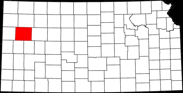
- Map of Logan County KS USA
- Early history
- 19th century
- Geography
- Major highways
- Adjacent counties
- Demographics
- Law and government
- Unified school districts
- Cities
- Unincorporated communities
- Townships
- References
Map of Logan County, KS, USA
One of the county's most distinctive features is a mile long stretch of Niobrara Formation rocks that reach 100 feet in the high and dubbed "Little Jerusalem" and which is related to the same geology that forms Badlands National Park. The formation is mostly on private land. In 2016 the Nature Conservancy about 10 percent of the Kansas rocks and says it intends to open them to the public.
Early history
For many millennia, the Great Plains of North America was inhabited by nomadic Native Americans. From the 16th century to 18th century, the Kingdom of France claimed ownership of large parts of North America. In 1762, after the French and Indian War, France secretly ceded New France to Spain, per the Treaty of Fontainebleau.
19th century
In 1802, Spain returned most of the land to France, but keeping title to about 7,500 square miles. In 1803, most of the land for modern day Kansas was acquired by the United States from France as part of the 828,000 square mile Louisiana Purchase for 2.83 cents per acre.
In 1854, the Kansas Territory was organized, then in 1861 Kansas became the 34th U.S. state. In 1887, Logan County was established.
Geography
According to the U.S. Census Bureau, the county has a total area of 1,073 square miles (2,780 km2), of which 1,073 square miles (2,780 km2) is land and 0.1 square miles (0.26 km2) (0.01%) is water.
Major highways
Adjacent counties
Demographics
At the 2000 census, there were 3,046 people, 1,243 households and 856 families residing in the county. The population density was 3 per square mile (1/km²). There were 1,423 housing units at an average density of 1 per square mile (1/km²). The racial makeup of the county was 96.72% White, 0.59% Black or African American, 0.16% Native American, 0.20% Asian, 0.72% from other races, and 1.61% from two or more races. 1.64% of the population were Hispanic or Latino of any race.
There were 1,243 households of which 29.50% had children under the age of 18 living with them, 59.30% were married couples living together, 6.30% had a female householder with no husband present, and 31.10% were non-families. 28.60% of all households were made up of individuals and 14.80% had someone living alone who was 65 years of age or older. The average household size was 2.40 and the average family size was 2.98.
Age distribution was 25.40% under the age of 18, 7.20% from 18 to 24, 24.40% from 25 to 44, 22.30% from 45 to 64, and 20.70% who were 65 years of age or older. The median age was 41 years. For every 100 females there were 93.60 males. For every 100 females age 18 and over, there were 93.00 males.
The median household income was $32,131, and the median family income was $40,104. Males had a median income of $28,105 versus $19,609 for females. The per capita income for the county was $17,294. About 4.70% of families and 7.30% of the population were below the poverty line, including 7.80% of those under age 18 and 8.60% of those age 65 or over.
Law and government
Following amendment to the Kansas Constitution in 1986, the county remained a prohibition, or "dry", county until 2006, when voters approved the sale of alcoholic liquor by the individual drink without a food sales requirement.
Unified school districts
Cities
Unincorporated communities
Townships
Logan County is divided into eleven townships. None of the cities within the county is considered governmentally independent, and all figures for the townships include those of the cities.
In the following table, the population center is the largest city (or cities) included in that township's population total, if it is of a significant size.