
 | ||
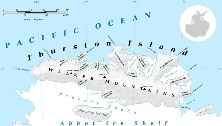
Lofgren Peninsula (72°12′S 96°4′W) is an ice-covered peninsula about 22 nautical miles (40 km) long, ending at Cape Menzel projecting between Cadwalader Inlet and Morgan Inlet on the northeast side of Thurston Island, Antarctica. It was discovered in helicopter flights from the USS Burton Island and the USS Glacier of the U.S. Navy Bellingshausen Sea Expedition in February 1960, and was named by the Advisory Committee on Antarctic Names for Charles E. Lofgren, personnel officer with the Byrd Antarctic Expedition, 1928–30.
Maps
References
Lofgren Peninsula Wikipedia(Text) CC BY-SA