
Max. width 0.25 mi (0.40 km) Area 8 ha Primary outflow Loch Skae Burn | Primary outflows Loch Skae Burn Max. length 0.75 mi (1.21 km) Surface elevation 267 m Shore length 1.1 km Number of islands 0 | |
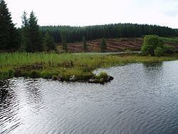 | ||
Loch Skae is a small, upland freshwater loch to the north of Blackcraig Hill, approximately 18 miles (29 km) west of Dumfries, Scotland and 0.5 mi (0.80 km) east of Loch Howie. The loch is somewhat circular in shape with a maximum diameter of 0.25 mi (0.40 km) from north to south. It has an average depth of 9.5 ft (2.9 m) and is 35 ft (11 m) at its deepest point. The loch was surveyed on 29 July 1903 by James Murray as part of Sir John Murray's Bathymetrical Survey of Fresh-Water Lochs of Scotland 1897-1909.
Map of Loch Skae, Castle Douglas, UK
References
Loch Skae Wikipedia(Text) CC BY-SA