
Country New Zealand Territorial authority Postcode 7472 Local time Friday 4:51 AM | Region Canterbury Time zone NZST (UTC+12) Elevation 116 m Area code 03 | |
 | ||
Electorates KaikouraTe Tai Tonga (Maori electorate) Weather 10°C, Wind NE at 10 km/h, 96% Humidity | ||
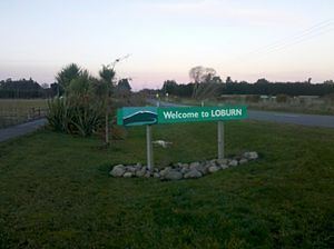
Loburn is a rural community in North Canterbury, New Zealand. It is located ten kilometres northwest of Rangiora and nearly 50 kilometres north of Christchurch.
Contents
Map of Loburn, New Zealand
Loburn is a small community, with no shops. Local industries include a cheese factory and orchards. Farms in the community include those raising sheep, cattle and emu.
Geography
Loburn is located close to the northern most extreme of the Canterbury Plains. It is bounded to the south and west by the Ashley and Okuku rivers, respectively. To the north it is bounded by the foothills, Mount Grey / Maukatere (933m) and Mt Karetu (972m) and bounded to the east by the Ashley forest.
The Loburn-Ashley fault zone is located from the northern banks of the Ashley River through to about Hodgsons road in the north, it runs parallel to the Ashley river. The Loburn fault, which runs along the south side of Hodgsons Road, is responsible for various terraced abandoned stream channels, wedge structures and scarps, notably Round Hill. The topography in Loburn is generally flat with gently rolling hills, altitude gradually decreases southwards from the foothills.
Education
Loburn has two schools.
Loburn School (est. 1869) is a decile 9 state co-educational primary school with a role of 162 students (as of July 2016). The principal is Stuart Priddy.
North Loburn School (est. 1882) is a decile 9 state co-educational primary school with a role of 123 students (as of July 2016). The principal is Darryn Ward.