
Primary outflows Lobster Stream Max. length 4.7 mi (7.6 km) Surface area 3,380 acres (1,370 ha) Surface elevation 294 m | Basin countries United States Max. width 1.5 mi (2.4 km) Max depth 32 m Area 13.68 km² | |
 | ||
Location Piscataquis County, Maine | ||
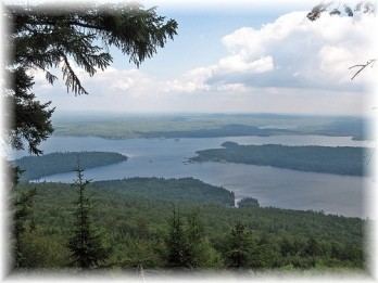
Lobster Lake in the North Maine Woods was named because its shape resembles the outline of a lobster. The northwest corner of the lake in Northeast Carry township resembles a curled lobster tail, while the lake extending eastward into Lobster township resembles a lobster thorax. The larger eastern arm of the lake extending southward is Big Claw and a smaller western arm is Little Claw. Lobster Stream connects the northwest corner of the lake to the West Branch Penobscot River 1.4 miles (2.3 km) north of the lake. Lobster Lake and the river are at a similar elevation; so the West Branch may temporarily reverse flow through Lobster Stream into the lake during peak runoff events from the western Maine highlands along the Canadian border. The lake has self-sustaining populations of native lake trout and land-locked Atlantic salmon; but brook trout populations are suppressed by competition from yellow perch and white perch.