
- location The Presidio | - elevation 0 ft (0 m) | |
 | ||
Similar Presidio of San Francisco, Baker Beach, Mountain Lake Park, El Polin Spring, China Beach - San Francisco | ||
Lobos creek the ansel adams connection
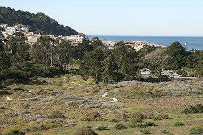
Lobos Creek (from the Spanish for sea lion, lobo marino — literally, "sea wolf") is a stream in the Presidio of San Francisco in San Francisco, California.
Contents
- Lobos creek the ansel adams connection
- Map of Lobos Creek San Francisco CA USA
- New improved version lobos creek the lobos legacy and ansel adams
- OverviewEdit
- References
Map of Lobos Creek, San Francisco, CA, USA
New improved version lobos creek the lobos legacy and ansel adams
OverviewEdit
Lobos Creek runs from runoff in the Presidio and Seacliff areas and underground seepage from springs that form Mountain Lake to the Pacific Ocean, marking the division between Baker Beach and China Beach. Conservation and restoration efforts are under way to remove invasive vegetation and improve water flow, in addition to deculverting.
Lobos Creek is the Presidio's primary source of potable water. About a million gallons per day—half the average flow of the creek—is diverted to a water treatment facility in the Presidio.
Broken pipes also leak raw sewage into the creek, causing a pool at Baker Beach and Lobos Creek where children play to be the most contaminated in the Bay Area.