
Topo map USGS Carvers Gap Prominence 198 m | Elevation 1,678 m | |
 | ||
Parent ranges Unaka Range, Blue Ridge Mountains Similar Big Yellow Mountain, Grassy Ridge Bald, Little Hump Mountain, Mount Mitchell, Roan Mountain | ||
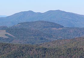
Little Yellow Mountain is a mountain in the North Carolina High Country and wholly in the Pisgah National Forest. Its elevation reaches 5,504 ft (1,678 m), it is on the border between Avery and Mitchell counties. The mountain generates feeder streams for the North Toe River.
Contents
Map of Little Yellow Mountain, Cane Creek, NC 28705, USA
Though named Little Yellow Mountain, it is actually 64 ft (20 m) taller than nearby Big Yellow Mountain.
On December 3, 2009, the Nature Conservancy announced the acquisition of 466 acres (1.89 km2) at the summit of Little Yellow Mountain. The future goal is to transfer the land to the North Carolina State Parks System, becoming part of the Yellow Mountain State Natural Area.
Macon CountyEdit
There is also a Little Yellow Mountain in Macon County, North Carolina with an elevation of 4,249 ft (1,295 m).