
 | ||
Main source Canadian Rockies1,470 m (4,820 ft) River mouth Smoky River385 m (1,263 ft) Discharge Average rate:25 m/s (880 cu ft/s) | ||
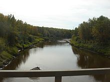
2015 08 02 fishing in little smoky river
Course
The river originates in the foothills of the Canadian Rockies, west of Grande Cache and flows in a north-east direction throughout the foothills. Upon reaching the open prairie, it meanders northwards and merges into the Smoky River south of the town of Watino. From here, its waters are carried to the Arctic Ocean through the Peace, Slave and Mackenzie Rivers.
The Little Smoky River has an average discharge of 25 m³/s, and can reach over 100 m³/s in spring.
The towns of Valleyview and Little Smoky are located in the Little Smoky River basin.
Tributaries
References
Little Smoky River Wikipedia(Text) CC BY-SA