
Airport type Public 11/29 5,249 Phone +1 707-937-5129 | Elevation AMSL 572 ft / 174 m 5,249 1,600 Elevation 174 m | |
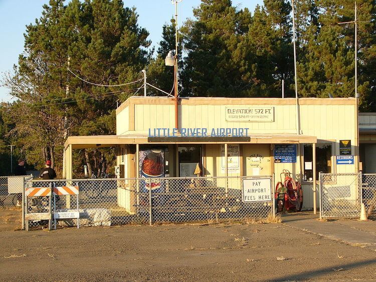 | ||
Address 43001 Little River-Airport Rd, Little River, CA 95456, USA Owner Mendocino County, California | ||
Landing at little river airport
Little River Airport (ICAO: KLLR, FAA LID: LLR, formerly O48) is a small county-owned public-use airport located three nautical miles (6 km) southeast of the central business district of Little River, in Mendocino County, California, United States.
Contents
- Landing at little river airport
- Watch us fly into little river airport california
- History
- Facilities and aircraft
- References
Although most U.S. airports use the same three-letter location identifier for the FAA and IATA, this airport is assigned LLR by the FAA but has no designation from the IATA.
Watch us fly into little river airport california
History
In 1945, this airport was built by the Navy served as an outlying field to NALF Santa Rosa. The Naval Auxiliary Air Station at Santa Rosa, California, was part of a network of training airfields supporting Naval Air Station Alameda.
The airport enjoyed commercial air service in the late 1940s/early 1950s, provided by Southwest Airways utilizing World War II surplus DC-3's.
Facilities and aircraft
Little River Airport covers an area of 548 acres (222 ha) and contains one asphalt paved runway designated 11/29 which measures 5,249 by 150 feet (1,600 x 46 m). For the 12-month period ending February 4, 2004, the airport had 6,300 aircraft operations, an average of 17 per day: 98% general aviation and 2% air taxi.
New for 2006: Super AWOS weather for pilots on CTAF 122.70 by clicking your mic 3 times.