
Type natural, mesotrophic Basin countries United States Max depth 6.1 m Area 56 ha Shore length 4.5 km | Primary outflows Deschutes River Surface area 138 acres (56 ha) Surface elevation 1,446 m Mean depth 2.4 m Outflow location Deschutes River | |
 | ||
Primary inflows Catchment area 18 square miles (47 km) | ||
Little Lava Lake lies in the Cascade Range about 26 miles (42 km) west-southwest of Bend in the U.S. state of Oregon. A close neighbor of Lava Lake, from which it is separated by solidified lava, Little Lava Lake is at an elevation of 4,744 feet (1,446 m) in the Deschutes National Forest. Generally considered the source of the Deschutes River, the lake covers 138 acres (56 ha) to an average depth of 8 feet (2.4 m).
Contents
Map of Little Lava Lake, Oregon 97703, USA
Lava Lake, Little Lava Lake, and other nearby lakes formed after lava flows from Mount Bachelor altered drainage patterns in the area. Solidified lava flows are visible along the shorelines of both lakes, and the volcanic peaks Broken Top and South Sister can be seen to the north.
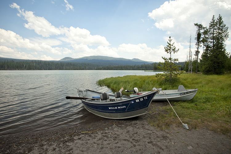
RecreationEdit
Fish in the lake include stocked rainbow trout, wild brook trout, and tui chub. Caught trout average 10 to 12 inches (25 to 30 cm) and sometimes reach 17 inches (43 cm). In addition to fishing, the lake is used for canoeing, rafting, and swimming.
A United States Forest Service campground is near the lake, and Big Lava Lake, about 1⁄4 mile (0.40 km) away, also has campsites. The Little Lava Lake campground has 13 campsites, two tent-only sites for large groups, and a boat ramp.
Trails in the area offer opportunities for hiking and horseback riding. One trail follows the west side of Little Lava Lake and leads south into Three Sisters Wilderness and on to Williamson Mountain.