
Population 892 (2011 census) Sovereign state United Kingdom Local time Friday 9:08 AM UK parliament constituency Wellingborough | OS grid reference SP8671 Post town Wellingborough Dialling code 01933 | |
 | ||
Weather 8°C, Wind NE at 24 km/h, 83% Humidity | ||
Little Harrowden is a village and civil parish in Northamptonshire nearly three miles north-west of Wellingborough, off the A509 road. At the time of the 2011 census, the parish's population was 892 people.
Contents
Map of Little Harrowden, Wellingborough, UK
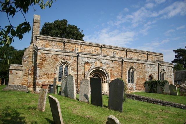
The village is one of the longest and narrowest parishes in Northamptonshire and is built around the Church of St Mary the Virgin, which dates back to circa 1190. The parish has a population of between 800-900 and this is spread across various occupations from industrial in the east to farming in the west.
The local primary school has been established for approximately 350 years and, along with the village hall, acts as a focal point in the village. Another focal point of the village is the pub, The Lamb, which is run by Charles Wells.
Governance
Little Harrowden is in the North Ward of the Borough Council of Wellingborough and in the Finedon area for Northamptonshire County Council. The Member of Parliament is Mr Peter Bone (Conservative, Wellingborough & Rushden).
Landmarks
St Mary's church dates mainly from the Norman period.