
Width 3.6 km (2.24 mi) Highest point Nonstinden Elevation 543 m Municipality Vågan | Length 4.0 km (2.49 mi) Highest elevation 543 m (1,781 ft) Area 9.7 km² | |
 | ||
Similar Svolværgeita, Vågakallen, Kongstindan, Trollfjord, Higravstinden | ||
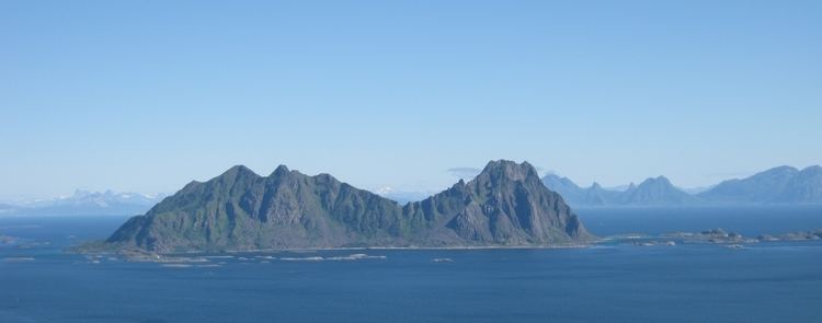
Litlmolla, is an island in the municipality of Vågan in Nordland county, Norway. The island lies east of Svolvær in the Vestfjorden. The island is located south of the large island of Austvågøya and Stormolla and northeast of Skrova. It has an area of about 10 square kilometres (3.9 sq mi). The highest point on the island is the 543-metre (1,781 ft) tall Nonstinden. The island was formerly inhabited, but has long since been abandoned.
Map of Lille Molla, 8300 Svolv%C3%A6r, Norway
References
Litlmolla Wikipedia(Text) CC BY-SA