In 2001, the old city of Ottawa was amalgamated with the suburbs of Nepean, Kanata, Gloucester, Rockcliffe Park, Vanier and Cumberland, and the rural townships of West Carleton, Osgoode, Rideau and Goulbourn, along with the systems and infrastructure of the Regional Municipality of Ottawa-Carleton, to become one municipality.
The city is now organized into 23 wards. This is a list of neighbourhoods and outlying communities within the City of Ottawa, Ontario, Canada.
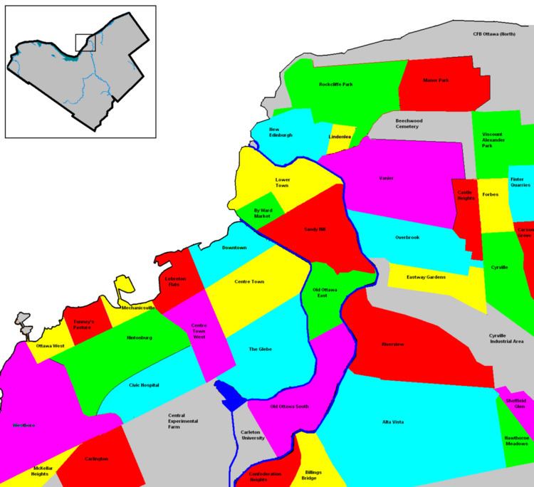
The following are populations of neighbourhoods that generally correspond to Statistics Canada census tracts.
Bank Street Promenade
Barrhaven
Bells Corners
Byward Market
Carp
Downtown Rideau
The Glebe
Heart of Orleans
Manotick
Preston Street
Somerset Street Chinatown
Somerset Village
Sparks Street
Vanier
Wellington Street West
Westboro Village
Ashburnham - Residential area downtown, bordered by Wellington St, Lyon St., Laurier Ave. and the Lebreton Aqueduct.
Bayswater - today part of the Hintonburg neighbourhood
Baytown - today part of the Westboro neighbourhood
Birchton - today part of the Westboro neighbourhood.
Britanniaville - included what is today the neighbourhoods of Britannia and Britannia Bay.
Cathartic - also known as Eastman's Springs. See Carlsbad Springs.
Clandeboye - today part of Vanier.
Evansville - today located in the neighbourhood of Carlington.
Gateville - located just south of Billings Bridge.
Village of Gloucester - today part of the Lindenlea neighbourhood south of New Edinburgh.
Janeville - see Vanier
Long Island Village - located opposite the north end of Long Island near the community of Manotick.
McLeansville - today part of Tunney's Pasture.
Merivale Village - today part of Carlington.
Mount Sherwood - 19th century community located around where the Adult High School on Gladstone is today
Nanny Goat Hill - 19th century community today part of the LeBreton Flats, located at the foot of the eponymous Nanny Goat Hill
Nepeanville - located where the Central Experimental Farm is today.
Parkview - today part of the Glebe.
Rideauville - today part of Old Ottawa South.
Rochesterville - today makes up Centretown West
Rockville - also known as Rock Village, this neighbourhood developed around Gloucester Quarries opened by Antoine Robillard on Montreal Road.
Stewarton - today makes up The Glebe and Centretown
St. Joseph - See Orléans.
Wellington - See Kars.
Willowdale - today part of the Eastway Gardens neighboruhood.
Main communities
This is a list of the main communities in the Ottawa area along with population numbers.
Greater areas and CMAs
Greater Ottawa-Gatineau Area population, year-end 2006: (pop. 1,316,830)
Ottawa-Gatineau CMA, mid-2006: (pop. 1,158,314)
Ottawa - (pop. 877,280)
Gatineau - (pop. 242,124)
Former cities
Ottawa - (pop. 382,076) (Downtown Ottawa, The Glebe, Centretown, Lower Town, Sandy Hill, Billings Bridge)
Cumberland - (pop. 52,430) (Former township, became city in 1999)
Gloucester - (pop. 110,264)
Kanata - (pop. 90,000)
Nepean - (pop. 124,878)
Vanier - (pop. 17,632)
Former villages
Rockcliffe Park - (pop. 1,927)
Former townships
Goulbourn
Osgoode
Rideau
West Carleton
Other main suburban areas
Orleans - (pop. 100,000) (located in the former cities of Cumberland and Gloucester)
Barrhaven - (pop. 70,000) (located in the former city of Nepean)
Stittsville - (pop. 18,913) (located in the former township of Goulbourn)
Bells Corners - (pop. 9,720)
Blackburn Hamlet - (pop. 8,955)
Hunt Club - (pop. 13,000)
Morgan's Grant - (pop. 8,000)
Riverside South - (pop. 8,000)
Riverview - (pop. 11,704)
Rural villages and hamlets
Dalmeny, Ontario (pop. unknown)
Pana, Ontario (pop. unknown)
Antrim (pop. unknown)
Corkery (pop. unknown)
Dwyer Hill (pop. unknown)
Burritts Rapids (pop. 100)
Ashton (pop. 108)
Galetta (pop. 177)
Dunrobin (pop. 288)
Kinburn (pop. 288)
Kenmore (pop. 321)
Fallowfield (pop. 366)
Edwards (pop. 402)
Sarsfield (pop. 474)
Vernon (pop. 597)
Kars (pop. 648)
Fitzroy Harbour (pop. 654)
Marionville (pop est. 900)
Vars (pop. 981)
Munster (pop. 1,320)
Carp (pop. 1,416)
Navan (pop. 1,593)
North Gower (pop. 1,749)
Cumberland (pop. 1,884)
Metcalfe (pop. 2,070)
Constance Bay (pop. 2,619)
Osgoode (pop. 2,784)
Richmond (pop. 3,301)
Greely (pop. 4,395)
Manotick (pop. 7,545)