Location State of Colorado Government County government | Number 64 | |
 | ||
Populations 699 (San Juan) – 622,263 (El Paso) Areas 34 square miles (88 km) (Broomfield City and County) – 4,773.27 square miles (12,362.7 km) (Las Animas) Subdivisions cities, towns, unincorporated communities, census designated place | ||
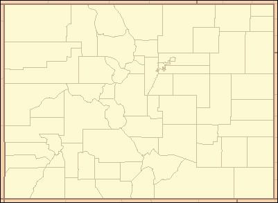
The U.S. state of Colorado is divided into 64 counties. Counties are important units of government in Colorado since the state has no secondary civil subdivisions, such as townships. Two of these counties, the City and County of Denver and the City and County of Broomfield, have consolidated city and county governments.
Contents
Colorado's ISO 3166-2:US state code is CO and its ANSI INCITS 38:2009 state code is 08.
When the Colorado Territory first began creating counties in 1861, 17 counties (Summit, Larimer, Weld, Boulder, Gilpin, Clear Creek, Jefferson, Arapahoe, Douglas, Lake, Conejos, Costilla, Park, Fremont, El Paso, Pueblo, and Huerfano) and a Cheyenne Reserve were formed. In February 1866, the first new county, Las Animas, was created, followed by Saguache in December of that year. Bent County was created in February 1870, followed by Greenwood the following month. On February 2, 1874, Grand County and Elbert County were formed, and on February 10, La Plata, Hinsdale, and Rio Grande counties were created. Greenwood was absorbed into Bent on February 5. The last county to be created under the Colorado Territory name was San Juan County, created three months before statehood. By the time Colorado became a state on August 1, 1876, it had only 26 counties. In January 1877, Routt and Ouray were formed, which was followed by Gunnison and Custer counties in March. In February 1879, Chaffee County was created. From February 8–10, 1879, Lake county was renamed Carbonate County. In 1881, Dolores County and Pitkin County were created. In 1883, Montrose, Mesa, Garfield, Eagle, Delta, and San Miguel counties were formed, leaving the total number of counties at 39. The number rose to 40 in 1885 with the creation of Archuleta County on April 14. Washington County and Logan County were both created in 1887. Between February 19 and April 16 in 1889, Morgan, Yuma, Cheyenne, Otero, Rio Blanco, Phillips, Sedgwick, Kiowa, Kit Carson, Lincoln, Prowers, Baca, and Montezuma counties were formed, bringing the total to 55. By 1900, Mineral County and Teller County had been added. On November 15, 1902, Arapahoe County split into Adams in the north and Denver was recognized as a consolidated city-county. By 1912, Jackson County, Moffat County, and Crowley County had been created. Alamosa was created in 1913, and in 2001, Broomfield was recognized as a city-county, bringing a total of 64 counties.
Table 2
The following sortable table lists the 64 counties of the state of Colorado with the following information:
- The official name of the county,
- The International Committee for Information Technology Standards (INCITS) county code.
- The date the county was established,
- The county seat,
- The rank among the 64 counties of Colorado by population as of July 1, 2013, as estimated by the United States Census Bureau,
- The county population as of July 1, 2013, as estimated by the United States Census Bureau,
- The county population as of April 1, 2010, as enumerated by the 2010 United States Census,
- The percent population change from April 1, 2010, to July 1, 2013,
- A link to a detailed transportation map of the county.
- The average population density per land area of the county as of July 1, 2012,
- The land area of the county,
- The water area of the county,
- The total area of the county,
- The maximum surface elevation in the county,
- The minimum surface elevation in the county,
- The reference latitude of the county, and
- The reference longitude of the county.
Former counties
The sortable table below lists all the historic counties of the Territory of New Mexico, the Territory of Utah, the Territory of Kansas, and the extralegal Territory of Jefferson that previously existed within the boundaries of the present State of Colorado, as well as the three defunct counties of the Territory of Colorado and the three defunct counties of the State of Colorado. The table includes the following information:
- The official name of the county,
- The territory or state,
- The date the county was created,
- The date the county was abolished or excluded from the new Territory of Colorado, and
- Historical notes.
No organized counties of the District of Louisiana, the Territory of Missouri, the extralegal State of Deseret, or the Territory of Nebraska existed within the present boundaries of the state of Colorado.
