
 | ||
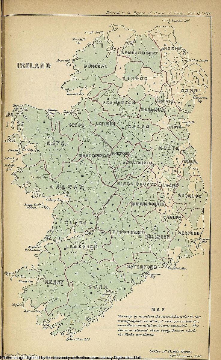
This is a list of the baronies of Ireland. Baronies were subdivisions of counties, mainly cadastral but with some administrative functions prior to the Local Government (Ireland) Act 1898.
Contents
Final list
The final catalogue of baronies numbered 331. A figure of 273 is also quoted, by combining those divided into half-baronies, as by East/West, North/South, or Upper/Middle/Lower divisions.
Every point in Ireland is in precisely one of the listed divisions. However, the municipal area of the four cities with barony status in 1898 has extended since then into the surrounding baronies. Prior to 1898, the baronies around Dublin City were shrunk according as they ceded land to the expanding city; but there is now land which is both within the current city boundaries and within one of the pre-1898 county baronies. Notably, the Barony of Dublin, created in 1842, is entirely within the city, although still separate from the Barony of Dublin City.
Creation date is sometimes specified as an upper bound (and possibly a lower bound) rather than the precise year:
Notes:
Former baronies
The names of more recently abolished baronies are generally preserved in the successor baronies; e.g. "Massereene" was split into "Massereene Lower" and "Massereene Upper", and "Coshmore" and "Coshbride" were merged into Coshmore and Coshbride.
The Municipal Corporations (Ireland) Act 1840 (3 & 4 Vict. c.108) separated the rural hinterland or "liberties" from some of the counties corporate, restricting their jurisdiction to the relevant municipal town, borough, or city. The Counties and Boroughs (Ireland) Act 1840 (3 & 4 Vict. c.109) provided that the rural area would form a new barony of the adjacent county until the county Grand Jury should decide to allocate it to an existing barony. The reallocation happened quickly in some cases, slower in others, and not at all in three cases: the baronies of Cork and Galway, and the Louth barony of Drogheda.
The "half barony of Varbo" shown between Trughanacmy and Corkaguiny on the map of the Desmond or Clancarthy Survey of 1598 may correspond to the medieval cantred of Uí Fearba / Hy Ferba / "Offariba otherwise Arbowe", which comprised the castle and lands of Listrim and Ballinoe.
A barony of Drogheda in County Meath is listed in the 1841 and 1851 censuses. The territory included is the portion of the County of the Town of Drogheda outside the municipal borough of Drogheda and south of the River Boyne; this was detached from the County of the Town under the 1840 Act. However, the Local Government (Drogheda and Meath) Act 1845 first recites that this area was in fact transferred to County Louth under the 1840 Act (as part of the Louth barony of Drogheda) and then goes on to transfer the land to County Meath as part of Lower Duleek barony.