
 | ||
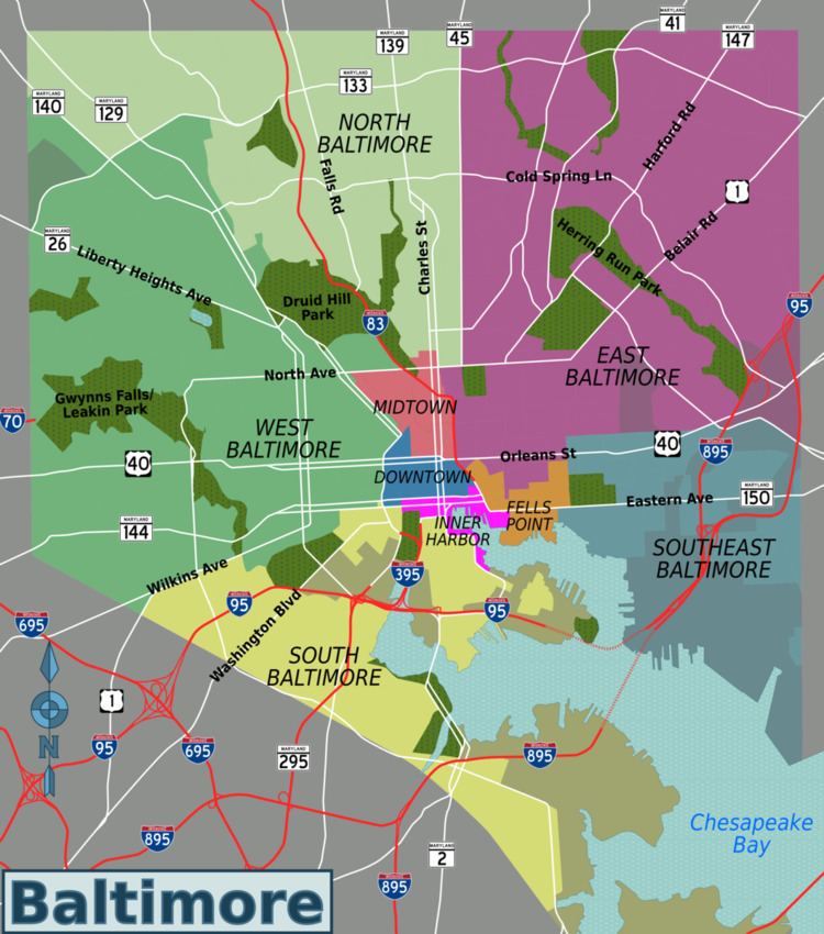
Neighborhoods in the City of Baltimore are officially divided into nine geographical regions: North, Northeast, East, Southeast, South, Southwest, West, Northwest, and Central, with each district patrolled by a respective Baltimore Police Department. Interstate 83 and Charles Street down to Hanover Street and Ritchie Highway serve as the east-west dividing line and Eastern Avenue to Route 40 as the north-south dividing line. However, Baltimore Street is north-south dividing line for the U.S. Postal Service. It is not uncommon for locals to divide the city simply by East or West Baltimore, using Charles Street or I-83 as a dividing line, or into North and South using Baltimore Street as a dividing line.
Contents
Map of Baltimore, MD, USA
The following is a list of major neighborhoods in the city of Baltimore, Maryland, organized by broad geographical location within the city. See below for a list of maps published by the City of Baltimore Department of Planning.