
Population 591 (2011 census) State electorate(s) Buninyong Postal code 3360 | Postcode(s) 3360 Linton ScarsdaleHappy Valley Local time Saturday 10:50 PM | |
 | ||
LGA(s) Golden Plains ShireShire of Pyrenees Weather 19°C, Wind NE at 14 km/h, 55% Humidity Federal divisions Division of Corangamite, Division of Wannon | ||
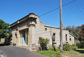
Linton is a town in Victoria, Australia, off Glenelg Highway. Most of the town is located in Golden Plains Shire; however, a small section is in the Shire of Pyrenees. At the 2011 census, Linton and the surrounding area had a population of 591. The Clarkesdale Bird Sanctuary lies to the south-east of the township, near Springdallah Creek.
Contents
Map of Linton VIC 3360, Australia
History
Linton was first settled about 1840. The town was named after a pioneer family in an area.
Gold was found in 1848 in what later became known as Linton's Diggings. Chinese people, among others, mined the local shafts until the gold ran out, the miners remained in the area and set up market gardens. The Post Office opened on 5 November 1857 as Linton's and was renamed Linton around 1860. Much mining equipment can still be found in the Linton district.
The ALP politician and Leader of the Federal Opposition 1922-28, Matthew Charlton, was born in Linton in 1866.
In December 1998, five firefighters were killed when they became trapped in a tanker while battling a bushfire near Linton.