
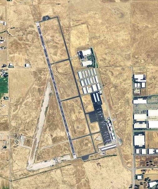
Airport type Public 15/33 6,001 Elevation 37 m | Owner City of Lincoln Elevation AMSL 121 ft / 37 m 6,001 1,829 Phone +1 916-645-3443 | |
 | ||
Address 1480 Flightline Dr, Lincoln, CA 95648, USA Similar Auburn Municipal Airport, Sacrame Internatio Airport, Skydive Sacrame, McClellan Airfield, Yuba County Airport‑Myv | ||
Lincoln Regional Airport (ICAO: KLHM, FAA LID: LHM, formerly O51) (Karl Harder Field) is a public airport three miles (5 km) west of Lincoln, in Placer County, California. It is owned by the City of Lincoln.
Contents
Most U.S. airports use the same three-letter location identifier for the Federal Aviation Administration and International Air Transport Association, but Lincoln Regional Airport is LHM to the FAA and has no IATA code.
Facilities
The airport covers 725 acres (293 ha); its one runway (15/33) is 6,001 x 100 ft (1,829 x 30 m) asphalt.
In the year ending June 10, 1993 the airport had 71,000 aircraft operations, average 194 per day: 96% general aviation and 4% air taxi. 207 aircraft are based at the airport: 92% single engine, 7% multi-engine, 1% jet and <1% helicopters.
World War II
During World War II the airport was Lincoln Air Force Auxiliary Field and was an auxiliary training airfield for Mather Army Airfield, California.