
Country Philippines Time zone PST (UTC+8) Area 50.3 km² Neighborhoods Estela, Himayangan, Bahay | Barangays ZIP code 6612 Province Southern Leyte | |
 | ||
Region Eastern Visayas (Region VIII) District Lone district of Southern Leyte | ||
Suroy sa liloan southern leyte
Liloan is a 4th class municipality in the province of Southern Leyte, Philippines. According to the 2015 census, it has a population of 23,981 people.
Contents
- Suroy sa liloan southern leyte
- Map of Liloan Southern Leyte Philippines
- House and lot for sale in liloan southern leyte liloan eastern visayas region 8
- Barangays
- Demographics
- Places of interest
- References
Map of Liloan, Southern Leyte, Philippines
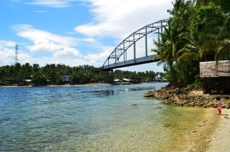
Liloan's town center is located at the northern part of Panaon Island which is connected to the mainland of Leyte by a bridge (Wawa Bridge).
"Liloan" is derived from the local term lilo, meaning "whirlpool". Whirlpools can be seen at Panaon Strait, the navigable narrow waterway between the mainland of Leyte and Panaon island.
House and lot for sale in liloan southern leyte liloan eastern visayas region 8
Barangays
Liloan is politically subdivided into 24 barangays.
Demographics
Population per barangay:
Places of interest
- Bitoon Beach, 500 meters from the Wawa Bridge
- Molopolo Beach @ Brgy Molopolo
- Tagbak Marine Park (250 meters from Wawa Bridge)
- Our Lady of Mt. Carmel Cross (pilgrim site)
- Duwangan Beach
- Liloan Lighthouse
- Liloan Ferry Terminal
- Pres. Quezon (maugoc) Pook Adventure Park (adventure site)
- Ollie's Wall (Dive Site) @ Gud-an
- Washing Machine Dive @ Wawa channel
References
Liloan, Southern Leyte Wikipedia(Text) CC BY-SA