
Time zone CET (UTC+1) Area 7 km² Population 1,203 (1 Jan 2016) Area code 055 | Elevation 20 m (70 ft) Postcodes 7364 Local time Friday 9:46 AM | |
 | ||
Weather 8°C, Wind W at 18 km/h, 64% Humidity | ||
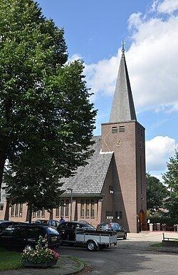
Lieren is a village in the Netherlands and part of the municipality of Apeldoorn. It is situated about 8 km ( 5 miles) south-east of the city centre of Apeldoorn and 2 km east of Beekbergen. It had 1,203 inhabitants in January 2016.
Map of Lieren, Netherlands
Despite its size, Lieren has a primary school, a bakery and a few DIY-stores. Most of its income come from tourism, with the Veluwe close at hand and multiple camping sites nearby. Also, a steam-train station belonging to the VSM attracts many tourists.
Once in every 4 years, the Uutbuurt takes place in Lieren. This is an event at which almost the whole village is present. At this event some local bands and artists perform and a sheep is to be won on a lottery.
References
Lieren Wikipedia(Text) CC BY-SA