
Prominence 61 m | Easiest route 5.6 The Beckey Route | |
 | ||
Elevation 7,720+ft (2,350+m) NGVD 29 Similar Mount Shuksan, Silver Star Mountain, Black Peak, Goode Mountain, Mount Despair | ||
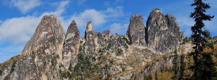
Liberty Bell Mountain is located in the North Cascades, approximately one mile south of Washington Pass on the North Cascades Highway. Liberty Bell is the most northern Spire of the Liberty Bell Group, a group of spires which also includes Concord Tower, Lexington Tower, North Early Winters Spire, and South Early Winters Spire.
Contents
Map of Liberty Bell Mountain, Washington 98862, USA
A well known peak in Washington, although it lacks high prominence, and elevation. It is well known for having high quality alpine climbing, with a short approach since the completion of The Washington Pass Hwy. A mixture of high quality granite and difficult rock, has made it a very popular weekend climbing area. Routes range from 5.6 class and grade II, to 5.12a class, and grade IV to V.
Rock Climbing RoutesEdit
Liberty Bell Mountain features 18 named traditional climbing routes. Liberty Crack is featured in Fifty Classic Climbs of North America. The first ascent was on September 27, 1946 by Fred Beckey, Jerry O’Neil, and Charles Welsh by way of what is now known as the Beckey route.