
Open tothe public Yes Materials Local stone. Garrison British Forces Year built 1901 | Condition Intact | |
 | ||
Type Natural rock formation, Dry Wall construction. | ||
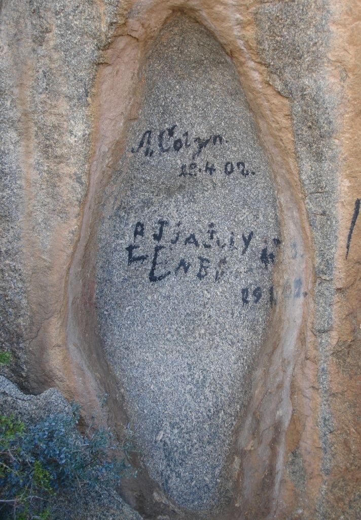
The Letterklip, Afrikaans for "lettered rock", is a provincial heritage site in Namaqualand in the Northern Cape province of South Africa. The unique rock formation was fortified by dry stone walling; it was occupied from 1901 to 1902 by British forces during the Anglo-Boer War. Various regimental badges and officers' names are engraved in the rockface.
Contents
Map of Letterklip, Garies, 8220, South Africa
History
In 1980, it was described in the Government Gazette of South Africa:
This unique rock formation was fortified and occupied from 1901 to 1902 by the British forces during the Anglo-Boer War. Various regimental badges and officers' names are engraved in the rockface.
References
Letterklip Wikipedia(Text) CC BY-SA