Intercommunality Bourbre-Tisserands Area 6.89 km² | Canton Chartreuse-Guiers Population (2009) 3,186 | |
 | ||
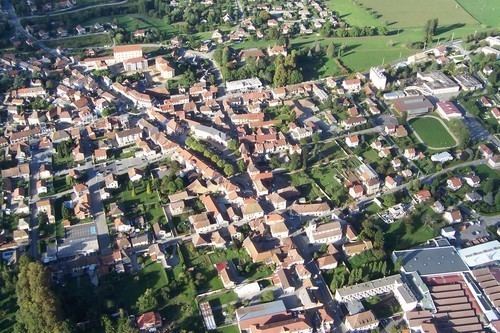
Les Abrets is a former commune in the Isère department in the Auvergne-Rhône-Alpes region of southeastern France. On 1 January 2016, it was merged into the new commune of Les Abrets-en-Dauphiné.
Contents
- Map of 38490 Les Abrets France
- Geography
- Toponymy
- Administration
- Population
- Sites and Monuments
- Notable People linked to the commune
- References
Map of 38490 Les Abrets, France
The inhabitants of the commune are known as Abrésiens or Abrésiennes
Geography
Les Abrets is located some 30 km west of Chambery and 25 km east of Bourgoin-Jallieu. The commune can be accessed on the D1075 road from the north-west continuing through the commune and the village to La Bâtie-Divisin in the south. The D1006 highway comes from La Tour-du-Pin in the west and intersects the D1075 in the centre of the village then continues to Le Pont-de-Beauvoisin in the east. There is also the D142E road from the village going north-east, the D592 which goes north from the village continuing to Chimilin, and the D142 going north-west to Fitilieu. A railway passes through the commune from west to east with a station just outside the western edge of the commune. The urban area of Les Abrets covers a large portion of the commune with a belt of forest running north to south through the centre of the commune. With some forested areas in the east of the commune and some forest in the east, the balance of the land area is farmland.
The Bievre stream flows south down the eastern edge of the commune. Other streams flow near the village and to the south.
Toponymy
The term Abrets comes from Albrez Albretum or Arbreta (from the Latin Arbor: relative to a tree). This wooded area was given to the "Poor Knights of Christ" in about 1124 who then became the Knights of the Temple of Jerusalem in 1128, known under the name of the Templars.
Administration
List of Successive Mayors of Les Abrets
(Not all data is known)
Population
In 2010 the commune had 3,455 inhabitants. The evolution of the number of inhabitants is known through the population censuses conducted in the commune since 1793. From the 21st century, a census of municipalities with fewer than 10,000 inhabitants is held every five years, unlike larger towns that have a sample survey every year.
Sources : Ldh/EHESS/Cassini until 1962, INSEE database from 1968 (population without double counting and municipal population from 2006)
