
- elevation 1,278 ft (390 m) - elevation 591 ft (180 m) | Basin area 51.54 km² | |
 | ||
- location north-northwest of Bloomingrose | ||
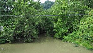
Lens Creek is a tributary of the Kanawha River, 6.4 miles (10.3 km) long, in West Virginia in the United States. Via the Kanawha and Ohio rivers, it is part of the watershed of the Mississippi River, draining an area of 19.9 square miles (52 km2) on the unglaciated portion of the Allegheny Plateau, in the Charleston metropolitan area.
Map of Lens Creek, 1, WV, USA
Lens Creek flows for its entire length in Kanawha County. It rises approximately 2.7 miles (4.3 km) north-northwest of the unincorporated community of Bloomingrose and flows generally northeastward through the unincorporated community of Hernshaw. It flows into the Kanawha River in the city of Marmet. The creek is paralleled for most of its course by West Virginia Route 94.
The creek was named after Leonard "Len" Morris, a pioneer settler.