Trisha Shetty (Editor)

Lengyel

Updated on
Edit
Like
Comment
Share on FacebookTweet on TwitterShare on LinkedInShare on Reddit
Country
  
Hungary

County
  
Tolna

Time zone
  
CET (UTC+1)

Area
  
20.03 km²

Population
  
652 (2004)

Region
  
Southern Transdanubia

Subregion
  
Bonyhádi

Postal code
  
7184

Local time
  
Wednesday 12:17 PM

Area code
  
74

Lengyel

Weather
  
13°C, Wind NW at 13 km/h, 49% Humidity

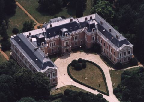
Lengyel (literally: "Pole", German: Lendl) is the highest inhabited village in Tolna County, Hungary. It is located between Bonyhád and Dombóvár.

Contents

Map of Lengyel, 7184 Hungary

Lengyel culture is named after the village.

Cultural events

  • Annabál
  • Pollen Youth Rock Festival
  • Notable aspects

  • Apponyi manor house surrounded by 22 hectares of park with botanical rarities.
  • Kindergarten museum
  • Svájceráj (a stable built in the Swiss fashion from the 19th century)
  • Apponyi basement
  • The post office and kindergarten building (The first Apponyi manor house, which is smaller in size)
  • Anna Bath - With 100 hectares of forested park, a school, a lake, and a small zoo.
  • Sánci Peak (A historical area protected by Mór Wosinsky) with a beautiful panorama of the Kapos Valley.
  • People

  • Sándor Apponyi
  • János Bogdán (hu)
  • József Cserháti (hu)
  • Mór Wosinsky (hu)
  • After approximately 200 years of residency, Lengyel's ethnic German Danube Swabian population was dispossessed of its property and forcibly removed to Germany following the end of World War II.

    References

    Lengyel Wikipedia