
Time zone CET/CEST (UTC+1/+2) Area 47.52 km² Population 4,567 (31 Dec 2008) | Elevation 440 m (1,440 ft) Postal codes 09514 Local time Wednesday 12:08 PM Postal code 09514 Dialling code 037367 | |
 | ||
Weather 9°C, Wind W at 21 km/h, 70% Humidity | ||
Lengefeld is a town and a former municipality in the district Erzgebirgskreis, in the Free State of Saxony, Germany. It is situated in the Ore Mountains, 23 km southeast of Chemnitz. On 1 January 2014 it was merged with the municipality Pockau to form the town Pockau-Lengefeld.
Contents
Map of Lengefeld, Pockau-Lengefeld, Germany
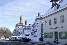
Sights
References
Lengefeld Wikipedia(Text) CC BY-SA