
- elevation 5,954 ft (1,815 m) - elevation 3,900 ft (1,189 m) Length 97 km Discharge 7.108 m³/s | - average 251 cu ft/s (7.11 m/s) Basin area 3,149 km² Basin area 3,149 km² | |
 | ||
- max 2,610 cu ft/s (73.91 m/s) - min 0.75 cu ft/s (0.02 m/s) | ||
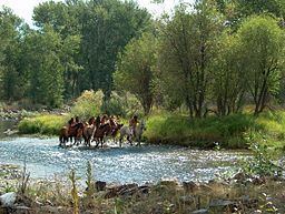
Lemhi river ranchers welcome home chinook salmon
The Lemhi River is a 60-mile-long (97 km) river in Idaho in the United States. It is a tributary of the Salmon River, which in turn is tributary to the Snake River and Columbia River.
Contents
- Lemhi river ranchers welcome home chinook salmon
- Map of Lemhi river Idaho USA
- Lemhi river
- CourseEdit
- River modificationEdit
- HistoryEdit
- References
Map of Lemhi river, Idaho, USA
Lemhi river
CourseEdit
From its source near Leadore and the confluence of several headwater streams, the Lemhi River flows generally northwest, through the Lemhi Valley, between the Lemhi Range to the west, and the Bitterroot Range and Beaverhead Mountains to the east. The Lemhi River flows into the Salmon River at the city of Salmon.
River modificationEdit
The water of the Lemhi River and its tributaries is used for irrigation agriculture. Of the river's mainstem tributaries, only 7% are not totally disconnected year round due to diversion for irrigation.
HistoryEdit
In August 1805 Lewis and Clark crossed the continental divide at the Lemhi Pass 10 miles (16 km) to the east of the Lemhi River. There, the group encountered a tribe of Shoshone Indians, one of whom turned out to be Cameahwait, brother of Sacagawea. The expedition sent a reconnaissance party, guided by Swooping Eagle, North along the Lemhi to the Salmon River attempting to find a navigable path, but turned back when they found that the Salmon was not passable by boat or on land.