
Founded 1862 Time zone PST (UTC+8) Local time Wednesday 4:54 PM University Lemery Colleges | District 1st District Barangays Area 109.8 km² | |
 | ||
Weather 29°C, Wind NE at 14 km/h, 65% Humidity Neighborhoods Calawang, Wawa Ibaba, Bagong Pook Points of interest Fantasy World, Archdiocesan Shrine of Our Lady, Casa Villavicencio, Galleria Taal | ||
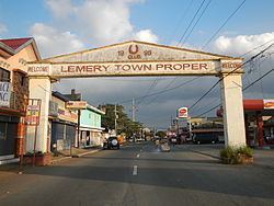
Lemery castle tour batangas by wow philippines travel agency
Lemery, officially the Municipality of Lemery (Filipino: Bayan ng Lemery), is a municipality in the province of Batangas in the Calabarzon (Region IV-A) of the Philippines. The population was 93,157 at the 2015 census. In the 2016 electoral roll, it had 50,518 registered voters.
Contents
- Lemery castle tour batangas by wow philippines travel agency
- Map of Lemery Batangas Philippines
- Fantasy world in lemery batangas province philippines
- History
- Geography
- Barangays
- Demographics
- Government
- Health
- Education
- Tourism
- References
Map of Lemery, Batangas, Philippines
The municipality was named after the Spanish Governor-General José Lemery e Ibarrola Ney y González (1811 – 1886).
Lemery is accessible by bus from Manila via the South Luzon Expressway (SLEX), and the Lipa STAR Tollway goes directly to Lemery. Furthermore, there are vans travelling from Manila to Lemery. Lemery can also be reached from Tagaytay via the Diokno highway.
Fantasy world in lemery batangas province philippines
History
During the early part of the 18th century, adventurous settlers from Taal, northern Mindoro and southern Cavite were attracted to the vast plain near the shores of Balayan Bay because of its abundance in fish and other marine life. Salting and drying fish became their major occupation due to the great demand of salted and dried fish by the people of Cavite, Mindoro, Laguna and Batangas. People came in great numbers to join the settlers, and the village became populous. The place was first called Punta, meaning "direction", because of the influx of people who went to the village. In 1818, the village of Punta was converted into one of the barrios of the Municipality of Taal.
The first priest who was assigned to the village was Fr. Geronimo. Upon the suggestion of the priest who succeeded him, the place was renamed San Geronimo in honor of this priest.
Captain Roberto Lemery, the Commanding Officer of San Geronimo outpost instructed the military and the church personnel to study the language of the native and cultivate harmony with them. When Captain Lemery died in 1856, the people of San Geronimo requested their priest to change the name of the barrio to Lemery. In 1858, the barrio of San Geronimo became officially known as Lemery.
In 1862, Lemery was separated from the Municipality of Taal and became the district municipality thru the efforts of Candida Cesario Valenzuela, Manuel Cabrera, Policarpio Mariño and Domingo Agoncillo. Jose Cabrera became the First Gobernadorcillo of the newly created town. For economic considerations, Lemery was again annexed to Taal in 1904. Finally by virtue of Executive Order 1549 of the Philippine Civil Commission, it became an independent Municipality in 1907.
Geography
Lemery is located at 13°55′N 120°53′E.
According to the Philippine Statistics Authority, the municipality has a land area of 109.80 square kilometres (42.39 sq mi) constituting 7000352000000000000♠3.52% of the 3,119.75-square-kilometre- (1,204.54 sq mi) total area of Batangas.
Barangays
Lemery is politically subdivided into 46 barangays. In 1957, the sitio of Bagong Pook was separated from the barrio of Arumahan and constituted into an independent barrio, while sitio of Masalisi was separated from Payapa.
Demographics
In the 2015 census, Lemery had a population of 93,157. The population density was 850 inhabitants per square kilometre (2,200/sq mi).
Most of the people in Lemery are Tagalogs. In recent years, there has been a noticeable increase of Visayans in some barrios or barangays. The main language spoken is Tagalog, and a significant number now speaks Cebuano. A small number of families speak Spanish. Many among the educated class can speak English.
In the 2016 electoral roll, it had 50,518 registered voters.
Government
Elected officials:
Health
Some of the health institutions in Lemery include:
Education
Schools in Lemery include: